 Guyane-SIG
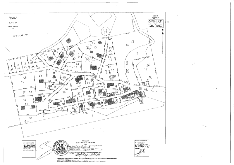
Document d'arpentage sur Ouanary (1999)
Carte scannée d'un document d'arpentage de la commune de Ouanary.
Simple
- Date (Publication)
- 1999-02-12T00:00:00
- Status
- Completed
Resource provider
Mairie de Ouanary
-
Annexe Mairie de Ouanary
1057 route de Baduel
,
CAYENNE
,
97300
,
Guyane française
Distributor
CTG - Collectivité Territoriale de Guyane
-
Service de l’Information Géographique
4179 route de Montabo - Carrefour de Suzini
,
CAYENNE
,
97300
,
Guyane Française
- Maintenance and update frequency
- Unknown
- Keywords
-
- document d'arpentage
- cadastre
- ouanary
- guyane
- 1999
- Region
-
- French Guiana
- GEMET - INSPIRE themes, version 1.0
-
- Parcelles cadastrales
- Other constraints
- Accord nécessaire du fournisseur de cette donnée en préalable au téléchargement
- Spatial representation type
- Vector
- Denominator
- 1250
- Metadata language
- Français
- Character set
- UTF8
- Topic category
-
- Planning cadastre
N
S
E
W
))
Distributor
Distributor
CTG - Collectivité Territoriale de Guyane
-
Service de l’Information Géographique
4179 route de Montabo - Carrefour de Suzini
,
CAYENNE
,
97300
,
Guyane Française
- Name
- TIFF
- OnLine resource
- CAD_OUANARY_1999-02-12_DA.tif ( WWW:DOWNLOAD-1.0-http--download )
- Hierarchy level
- Dataset
- File identifier
- 06ec4136-5cf4-42cf-b0b6-9f9528fc78ed XML
- Metadata language
- Français
- Character set
- UTF8
- Hierarchy level
- Dataset
- Date stamp
- 2014-09-29T18:38:33
- Metadata standard name
- ISO 19115:2003/19139
- Metadata standard version
- 1.0
Point of contact
CTG - Collectivité Territoriale de Guyane
-
Service de l’Information Géographique
4179 route de Montabo - Carrefour de Suzini
,
CAYENNE
,
97300
,
Guyane Française
Overviews

thumbnail
large_thumbnail
Spatial extent
N
S
E
W
Provided by

Associated resources
Not available