 Guyane-SIG
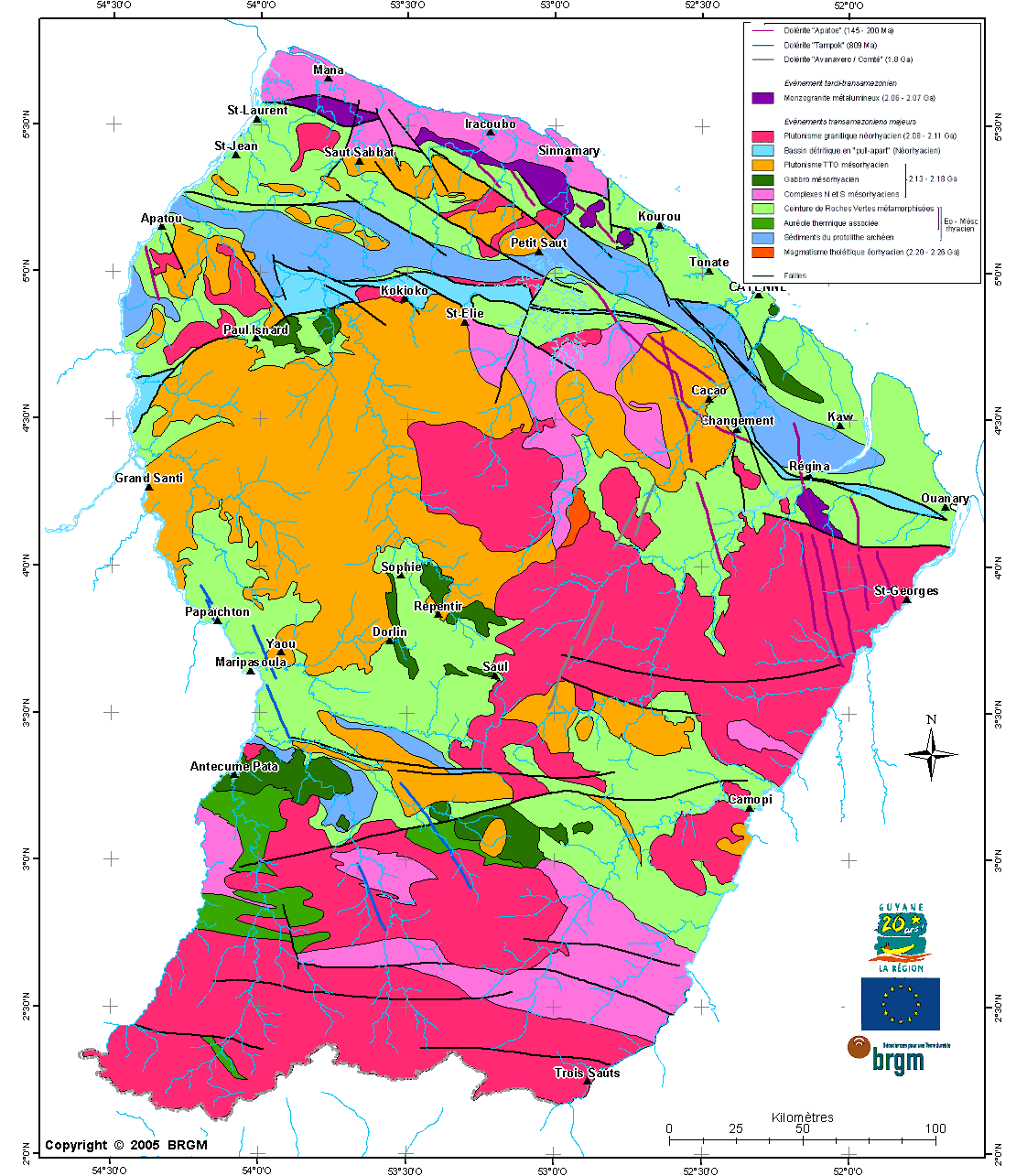
Ensemble de données du schéma structural de la Guyane de 2004 (2017)
Ensemble de couches d'informations vectorielles sur le schéma structural de la Guyane de 2004 (BRGM) initialement co-financée par la Région Guyane, reprojetée (en RGFG 95 UTM 22 Nord) et complétée en 2017 (CTG / GUYANE SIG).
Simple
- Date (Creation)
- 2017-09-19
- Status
- Completed
- Theme
-
- géologie ; sols ; Guyane ; schéma structural ; failles
- GEMET inspire themes - version 1.0
-
- Géologie
- Use limitation
- Mention obligatoire : "Réalisation CTG - Guyane SIG 2017 / BRGM 2004"
- Access constraints
- Intellectual property rights
- Classification
- Unclassified
- Spatial representation type
- Vector
- Metadata language
- fre
- Character set
- UTF8
- Topic category
-
- Geoscientific information
- Planning cadastre
N
S
E
W
))
- Reference system identifier
- EPSG / RGFG95 UTM22 / 7.4
- Reference system identifier
- INSPIRE RS registry / grégorien
- Distribution format
-
-
ESRI Shapefile
(
1.0
)
-
ESRI Shapefile
(
1.0
)
- OnLine resource
- Carte géologique du Schéma structural de la Guyane (2004) ( WWW:LINK-1.0-http--link )
- OnLine resource
- struc_guyane.gif ( WWW:DOWNLOAD-1.0-http--download )
- Hierarchy level
- Series
- File identifier
- 1f641ae8-d66f-4379-a053-a3209e0f8808 XML
- Metadata language
- fre
- Character set
- UTF8
- Parent identifier
- Base de données géologiques de Guyane (2017) 8d31e459-646e-4146-9820-f57c8adbdc70
- Hierarchy level
- Series
- Hierarchy level name
- Série de données
- Date stamp
- 2022-11-16T09:32:29
- Metadata standard name
- ISO 19115:2003/19139
- Metadata standard version
- 1.0
Overviews
Spatial extent
N
S
E
W
Provided by

Associated resources
Not available