 Guyane-SIG
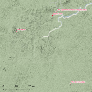
Guyadiv Nouragues: plot of forest inventory since 1985.
Guyadiv is a network of permanent forest plots set accross French Guiana. The Guyadiv plots in Nouragues last field sensus 1992; dbh min 10 cm ; 5 transects 500 x 20m + 1 transect 750 x 40m in 3 segments
Simple
- Date (Creation)
- 2019-07-05
- Date (Revision)
- 2019-07-05
- Date (Revision)
- 2019-07-05
- Date (Revision)
- 2019-07-05
- Date (Revision)
- 2019-07-05
- Date (Revision)
- 2019-07-05
- Date (Revision)
- 2019-07-05
- Date (Revision)
- 2019-07-05
- Identifier
- CEBA_Guyadiv_Nouragues
- Credit
- Prévost, Marie-François
- Status
- Completed
- Maintenance and update frequency
- Irregular
- GEMET - INSPIRE themes, version 1.0 INSPIRE themes
-
- Environmental monitoring facilities
- Geounits
-
- Americas
- South America
- France
- French Guiana
- GEMET - Concepts, version 2.4
-
- biodiversity
- forest conservation
- forest ecosystem
- tropical forest
- tropical forest ecosystem
- primary forest
- natural forest
- inventory of forest damage
- forest resource assessment
- Keywords
-
- local coverage
- labex CEBA
- dispositifs forestiers GUYADIV
- portail Ca-SIF
- Theme
-
- sampling plots
- mesoscale plot network
- forest structure
- tropical forest types
- forest composition
- permanent plots
- diameter measurements
- tree community
- tree flora
- Place
-
- Nouragues
- Use limitation
- Please get in touch with a point of contact.
- Access constraints
- Other restrictions
- Other constraints
- Agreement between potential user and point of contact.
- Classification
- Unclassified
- Aggregate Datasetindentifier
- 1ceaa8d3-0a19-49d4-8071-f9a52ce95822
- Association Type
- Cross reference
- Initiative Type
- Collection
- Aggregate Datasetindentifier
- 69cf02e7-4d4f-447d-b2ff-45acf0196ab2
- Association Type
- Cross reference
- Initiative Type
- Collection
- Spatial representation type
- Text, table
- Denominator
- 5000
- Metadata language
- fre
- Character set
- UTF8
- Topic category
-
- Biota
N
S
E
W
))
- Begin date
- 1985-01-01
- Reference system identifier
- EPSG / WGS 84 (EPSG:4326) / 7.9
- Distribution format
-
-
Shapefile
(
10.1
)
-
Shapefile
(
10.1
)
- Hierarchy level
- Dataset
- Statement
- 1. According to the shapefile Parare plots covers an area of 6ha and not 3ha as mentioned in the Metadata ?
- File identifier
- 33ff22b0-bbcc-4a36-8f17-762052c31f8b XML
- Metadata language
- eng
- Character set
- UTF8
- Parent identifier
- Guyadiv: a forest inventories network in French Guiana since 1986 aa753fe1-0e16-46a5-9971-decadb97adb3
- Hierarchy level
- Dataset
- Date stamp
- 2025-01-28T06:00:48
- Metadata standard name
- ISO 19115:2003/19139
- Metadata standard version
- 1.0
Overviews
thumbnail

large_thumbnail
Spatial extent
N
S
E
W
Provided by

Associated resources
Not available