 Guyane-SIG
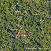
Terrestrial laser scanning (TLS) dataset, Paracou, French Guiana, acquired between 16 and 22 September 2014.
The terrestrial laser scanning (TLS) dataset covers the Guyaflux plot 9 of the experimental station Paracou in French Guiana.
Simple
- Date (Creation)
- 2016-05-04
- Identifier
- CEBA_TLS_Paracou_xx2014
- Status
- Completed
- Maintenance and update frequency
- Not planned
- GEMET - INSPIRE themes, version 1.0 INSPIRE themes
-
- Environmental monitoring facilities
- Geounits
-
- Americas
- South America
- France
- French Guiana
- GEMET - Concepts, version 2.4
-
- laser
- remote sensing
- vegetation cover
- Keywords
-
- local coverage
- labex CEBA
- Theme
-
- terrestrial laser scanning (TLS)
- Place
-
- Paracou
- Use limitation
- Please get in touch with a point of contact.
- Access constraints
- Other restrictions
- Other constraints
- Agreement between potential user and point of contact.
- Classification
- Unclassified
- Spatial representation type
- Vector
- Distance
- 1 mm
- Metadata language
- eng
- Character set
- UTF8
- Topic category
-
- Biota
N
S
E
W
))
- Begin date
- 2014-09-16
- End date
- 2014-09-22
- Reference system identifier
- EPSG / WGS 84 / UTM zone 22N (EPSG:32622) / 7.9
- Distribution format
-
-
LAS files
(
1.2
)
-
LAS files
(
1.2
)
- OnLine resource
-
CEBA_TLS_Paracou_XXxx2014.zip
(
WWW:DOWNLOAD-1.0-http--download
)
Shapefile terrestrial laser scanning (TLS) locations
- OnLine resource
-
CEBA_TLS_Paracou_XXxx2014.kmz
(
WWW:DOWNLOAD-1.0-http--download
)
Google Earth KMZ
- Hierarchy level
- Dataset
- Statement
- 1. Scans were co-registered using RiScanPro (Fine registration mode) 2. Absolute corregistration was ensured using 4 corners of plot which were located using DGPS and tacheometer to cm accuracy 3. The data (rxp files) are stored in \\forestview01\TLS\Paracou\2014
- File identifier
- a903d3c5-8f93-4af0-ac10-63822b065c83 XML
- Metadata language
- eng
- Character set
- UTF8
- Hierarchy level
- Dataset
- Date stamp
- 2025-01-28T06:02:26
- Metadata standard name
- ISO 19115:2003/19139
- Metadata standard version
- 1.0
Overviews
thumbnail

large_thumbnail
Spatial extent
N
S
E
W
Provided by

Associated resources
Not available