 Guyane-SIG
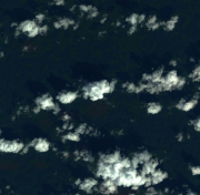
Satellite Image SPOT 6 Panchromatic and Multispectral 1.5m, Régina, French Guiana, acquired on 7 December 2014.
Subset of the image that covers the area around Régina in French Guiana.
Simple
- Date (Creation)
- 2015-12-07
- Identifier
- DS_SPOT6_201412071332160_FR1_FR1_SE1_SE1_W052N04_01303
- Status
- Completed
- Maintenance and update frequency
- Not planned
- GEMET - INSPIRE themes, version 1.0 INSPIRE themes
-
- Orthoimagery
- GEMET - Concepts, version 2.4
-
- remote sensing
- satellite image
- Geounits
-
- Americas
- South America
- France
- French Guiana
- Keywords
-
- Spot
- Spot 6
- local coverage
- labex CEBA
- Station de Réception Directe (SRD) GEOSUD
- Project DYNFORDIV
- Theme
-
- very high resolution satellite data (VHR)
- Place
-
- Régina
- Use limitation
- Please get in touch with a point of contact.
- Access constraints
- License
- Classification
- Unclassified
- Spatial representation type
- Grid
- Distance
- 1.5 m
- Metadata language
- eng
- Character set
- UTF8
- Topic category
-
- Imagery base maps earth cover
N
S
E
W
))
- Begin date
- 2015-12-07
- End date
- 2015-12-07
- Reference system identifier
- EPSG / WGS 84 / UTM zone 22N (EPSG:32622) / 7.9
- Distribution format
-
-
GeoTIFF
(
1.0
)
-
GeoTIFF
(
1.0
)
- OnLine resource
-
Airbus GeoStore
(
WWW:LINK-1.0-http--related
)
Airbus GeoStore
- OnLine resource
- LICENSE.PDF ( WWW:DOWNLOAD-1.0-http--download )
- OnLine resource
-
ORT_SPOT6_20141207_133218800_000.kmz
(
WWW:DOWNLOAD-1.0-http--download
)
Google Earth KMZ
- Hierarchy level
- Dataset
- Statement
- 1. Data received from SRD GEOSUD (see attached document).
- File identifier
- d8df71ea-c415-4756-8c53-8d9dddd45509 XML
- Metadata language
- eng
- Character set
- UTF8
- Hierarchy level
- Dataset
- Date stamp
- 2025-01-28T06:00:10
- Metadata standard name
- ISO 19115:2003/19139
- Metadata standard version
- 1.0
Overviews
thumbnail

large_thumbnail
Spatial extent
N
S
E
W
Provided by

Associated resources
Not available