Guyane-SIG
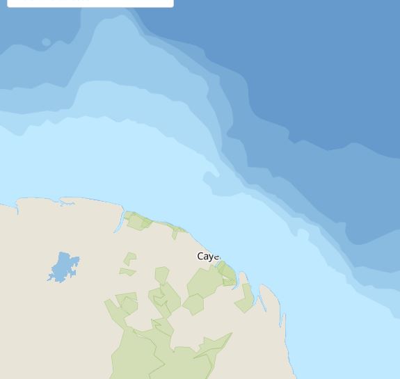
Bathymétrie du plateau des Guyanes
Bathymétrie composite du plateau des Guyanes réalisée par Guyane SIG, provenant des couches bathymétriques de Natural Earth (www.naturalearthdata.com), produites à partir des données issues du SRTM30\_PLUS \_V7\_Bathymetry de l'UCSD (Université de San Diego, Californie).
Simple
- Date (Creation)
- 2009-09-14
- Identifier
- ef3c6de5-3cae-47cc-b564-4ff5332630c0
- GEMET - INSPIRE themes, version 1.0
-
- Étendue géographique des données
- Theme
-
- bathymétrie
- Plateau des Guyanes
- Use limitation
- Données ouvertes
- Access constraints
- otherRestrictions Other restrictions
- Other constraints
- Données ouvertes
- Spatial representation type
- vector Vector
- Metadata language
- freFrançais
- Topic category
-
- environnement-et-climat
- mer-et-littoral
- Hierarchy level
- dataset Dataset
- File identifier
- ef3c6de5-3cae-47cc-b564-4ff5332630c0 XML
- Metadata language
- freFrançais
- Hierarchy level
- dataset Dataset
- Date stamp
- 2009-09-14
- Metadata standard name
- INSPIRE Metadata Implementing Rules
- Metadata standard version
- Technical Guidelines based on EN ISO 19115 and EN ISO 19119 (Version 1.2)