Guyane-SIG
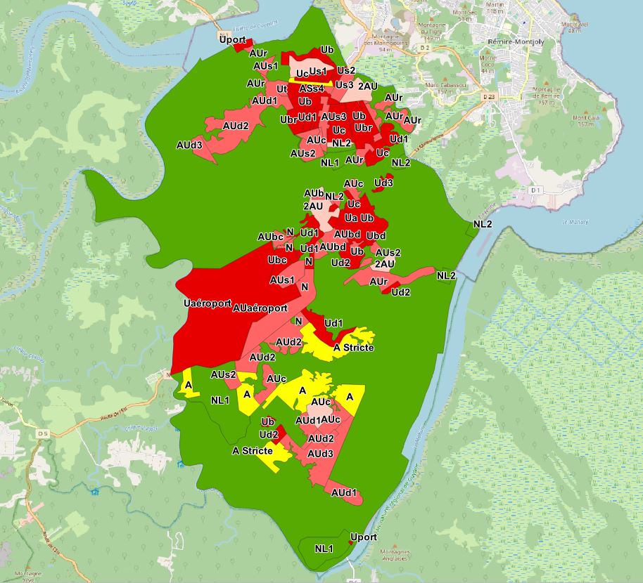
Plan local d'urbanisme de Matoury (22/12/2021) - opposable
Plan Local d'Urbanisme (PLU) de la commune de Matoury approuvé le 22/12/2021 - opposable.
Simple
- Date (Creation)
- 2021-12-22
- Identifier
- f642a128-4edf-44dd-a4e5-2495b26c481d
- GEMET - INSPIRE themes, version 1.0
-
- Étendue géographique des données
- Theme
-
- Planification/Cadastre
- PLU
- Plan Local d'Urbanisme
- Usage des sols
- Matoury
- Document d'urbanisme
- Zonage règlementaire
- Use limitation
- Utilisation libre sous réserve de mentionner la source (a minima le nom du producteur) et la date de sa dernière mise à jour
- Access constraints
- otherRestrictions Other restrictions
- Other constraints
- Utilisation libre sous réserve de mentionner la source (a minima le nom du producteur) et la date de sa dernière mise à jour
- Spatial representation type
- vector Vector
- Metadata language
- freFrançais
- Topic category
-
- amenagement-et-urbanisme
- Hierarchy level
- dataset Dataset
- Statement
- Document d’urbanisme numérisé conformément aux prescriptions nationales du CNIG du 08/12/2017.
- File identifier
- f642a128-4edf-44dd-a4e5-2495b26c481d XML
- Metadata language
- freFrançais
- Hierarchy level
- dataset Dataset
- Date stamp
- 2021-12-22
- Metadata standard name
- INSPIRE Metadata Implementing Rules
- Metadata standard version
- Technical Guidelines based on EN ISO 19115 and EN ISO 19119 (Version 1.2)