 Guyane-SIG
Outil du Foncier Agricole
L'Outil du Foncier Agricole de Guyane est un navigateur cartographique dont l'objectif est d'identifier les parcelles agricoles disponibles sur le domaine privé de l’État en Guyane afin d'aider les agriculteurs dans leur démarche de recherche de foncier.
Simple
Identification info
- Date (Publication)
- 2019-12-02T08:00:00
- Theme
-
- W_AUTRES
- W_A_CLASSER
- GUYANE
- X_A_CLASSER
- NIVEAU_DE_DIFFUSION
- GRAND_PUBLIC
- Keywords
-
- INSPIRE Service taxonomy
-
- infoMapAccessService
- OPENDATA
-
- données ouvertes
- open data
- Domaines
-
- ZONAGES_AGRICOLE
- FONCIER_AGRICOLE
- ASP
- AUDEG
- DAAF
- DGCAT
- GEOGUYANE
- Use limitation
- Utilisation libre sous réserve de mentionner la source (a minima le nom du producteur) et la date de sa dernière mise à jour.
- Access constraints
- Other restrictions
- Other constraints
- Pas de restriction d’accès publique
Contains Operations
- Operation Name
- Accès à la métadonnée de service WMS
- Distributed Computing Platforms
- Web services
- Service Type
- invoke
- Description
- Guyane
N
S
E
W
))
- Coupling Type
- Tight
Contains Operations
- Operation Name
- Accès à la carte
- Distributed Computing Platforms
- Web services
Contains Operations
- Operation Name
- Accès à la carte interactive
- Distributed Computing Platforms
- Web services
Contains Operations
- Operation Name
- Accès au fichier contexte OWS de la carte
- Distributed Computing Platforms
- Web services
Contains Operations
- Operation Name
- Accès à la carte interactive
- Distributed Computing Platforms
- Web services
Contains Operations
- Operation Name
- Accès au fichier contexte OWS de la carte
- Distributed Computing Platforms
- Web services
Contains Operations
- Operation Name
- Accès à la carte interactive
- Distributed Computing Platforms
- Web services
Contains Operations
- Operation Name
- Accès au fichier contexte OWS de la carte
- Distributed Computing Platforms
- Web services
Contains Operations
- Operation Name
- Accès à la carte interactive
- Distributed Computing Platforms
- Web services
Contains Operations
- Operation Name
- Accès au fichier contexte OWS de la carte
- Distributed Computing Platforms
- Web services
Contains Operations
- Operation Name
- Accès à la carte interactive
- Distributed Computing Platforms
- Web services
Contains Operations
- Operation Name
- Accès au fichier contexte OWS de la carte
- Distributed Computing Platforms
- Web services
Contains Operations
- Operation Name
- Accès à la carte interactive
- Distributed Computing Platforms
- Web services
- Connect Point
- https://catalogue.geoguyane.fr/geosource/consultation?id=66028224 ( WWW:LINK-1.0-http--link )
Contains Operations
- Operation Name
- Accès au fichier contexte OWS de la carte
- Distributed Computing Platforms
- Web services
Contains Operations
- Operation Name
- Accès à la carte interactive
- Distributed Computing Platforms
- Web services
- Connect Point
- https://catalogue.geoguyane.fr/geosource/consultation?id=66028224 ( WWW:LINK-1.0-http--link )
Coupled Resource
- Operation Name
- GetCapabilities
- Identifier
- 640b2706-1a5a-4ac0-8b69-4ff0855c3e3b
Coupled Resource
- Operation Name
- GetCapabilities
- Identifier
- 04cf382c-7a47-4d18-af8a-7c2dc34c9283
Coupled Resource
- Operation Name
- GetCapabilities
- Identifier
- dd75a538-5240-4171-80c7-072b62d90d6f
Coupled Resource
- Operation Name
- GetCapabilities
- Identifier
- cd457871-6f7a-43d6-9db9-57f8eb3caf3f
Coupled Resource
- Operation Name
- GetCapabilities
- Identifier
- d30ba2d5-8258-4170-a24a-d1a804bc6afa
Coupled Resource
- Operation Name
- GetCapabilities
- Identifier
- 8eaee679-0320-464c-9fbc-aea1092fb575
Coupled Resource
- Operation Name
- GetCapabilities
- Identifier
- 08a59540-6ab1-4f8a-a84f-8f1882b1fa16
Coupled Resource
- Operation Name
- GetCapabilities
- Identifier
- 12524e0b-11a7-4eb0-b91e-3eb996c1e638
Coupled Resource
- Operation Name
- GetCapabilities
- Identifier
- 5862adeb-c484-4bef-b984-c84196403cff
Coupled Resource
- Operation Name
- GetCapabilities
- Identifier
- a0016a9f-17d5-422b-ae8b-ccf23da607bd
Coupled Resource
- Operation Name
- GetCapabilities
- Identifier
- eb2fa9f1-92ee-491e-8b70-330f1382a8cc
Coupled Resource
- Operation Name
- GetCapabilities
- Identifier
- a0a8650e-6390-4d6c-84d5-c59802527da0
Coupled Resource
- Operation Name
- GetCapabilities
- Identifier
- f2e816d5-3fb1-4aa9-8d94-917c25cc57d0
Coupled Resource
- Operation Name
- GetCapabilities
- Identifier
- 8538b1bf-5652-4ade-9389-4ae0f02dff24
Coupled Resource
- Operation Name
- GetCapabilities
- Identifier
- 105e7769-275f-4080-827d-f456d638755b
Coupled Resource
- Operation Name
- GetCapabilities
- Identifier
- 5d0c83a7-7c0a-4fad-8db5-00bd7925765e
- Operates On
-
- 640b2706-1a5a-4ac0-8b69-4ff0855c3e3b
- 04cf382c-7a47-4d18-af8a-7c2dc34c9283
- dd75a538-5240-4171-80c7-072b62d90d6f
- cd457871-6f7a-43d6-9db9-57f8eb3caf3f
- d30ba2d5-8258-4170-a24a-d1a804bc6afa
- 8eaee679-0320-464c-9fbc-aea1092fb575
- 08a59540-6ab1-4f8a-a84f-8f1882b1fa16
- 12524e0b-11a7-4eb0-b91e-3eb996c1e638
- 5862adeb-c484-4bef-b984-c84196403cff
- a0016a9f-17d5-422b-ae8b-ccf23da607bd
- eb2fa9f1-92ee-491e-8b70-330f1382a8cc
- a0a8650e-6390-4d6c-84d5-c59802527da0
- f2e816d5-3fb1-4aa9-8d94-917c25cc57d0
- 8538b1bf-5652-4ade-9389-4ae0f02dff24
- 105e7769-275f-4080-827d-f456d638755b
- 5d0c83a7-7c0a-4fad-8db5-00bd7925765e
Contains Operations
- Operation Name
- Accès à la carte interactive
- Distributed Computing Platforms
- Web services
- Connect Point
- https://catalogue.geoguyane.fr/geosource/consultation?id=66028224 ( WWW:LINK-1.0-http--link )
- Reference system identifier
- EPSG / RGFG95 / UTM zone 22N (EPSG:2972) / 8.6
- Units of distribution
- liens associés
- OnLine resource
-
Accès à la carte
(
WWW:LINK-1.0-http--link
)
Accès à la carte
Overviews
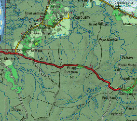
foncier_ofag.PNG
Spatial extent
N
S
E
W
Provided by

Associated resources
Not available