 Guyane-SIG
asNeeded
Type of resources
Available actions
Topics
Keywords
Contact for the resource
Provided by
Years
Formats
Representation types
Update frequencies
status
Service types
Scale
Resolution
-
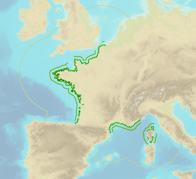
<strong>This data is not up to date with the order dated 30 August 2021 amending the order dated 23 November 1987 on ship safety, which now raises the limit for category 4 ships to 5 miles from the nearest coast.</strong> The navigation category allocated to a ship is indicated on its shipping license, together with any applicable restrictions. This limit was produced by Shom in application of section II.14 of article 1 of decree no. 84-810 amended on 30 August 1984. Navigation categories are defined in article 110.10 of the rules appended to the order of 23 November 1987 on shipping safety.
-
This database contains botanical records either relating to material present in one of the Naturalis collections, or to material that has been or is being used in research projects. The records usually relate to herbarium specimens, but it also contains data on silica-gel samples, wood samples, spirit collections, carpological collections, etc.; rarely to observations only. The Naturalis collections have their strong points in The Netherlands and surrounding countries, Southeast Asia and New Guinea, West- and Central-Africa, Ethiopia and the Guyanas.
-
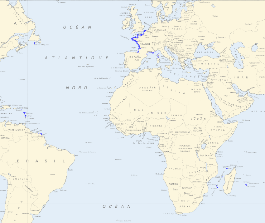
In accordance with decree no. n°2019-165 of 5 March 2019, Shom measures and updates maritime altimetric datums or hydrographic datums for French ports in mainland France and overseas administrative departments and authorities. These datums are provided to allow for standardisation based on legal altimetric datum systems (e.g. IGN69). Shom also disseminates typical tide figures for each port (lowest tide, mean tide, etc.). The Marine Altimetric Reference Value (RAM) product is available for ports in mainland France and for overseas territories with a tidal observatory.
-

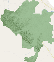
The Paracou Research Station encompasses 5000 ha of tropical rain forest near Sinnamary, French Guiana, and is accessible by paved road. The site includes several types of forest plots, each with unique research objectives. Logging Plots: Fifteen nine-hectare plots (numberred 1 to 15) were established in 1984 to study the impact of different logging treatments on tropical tree population structure. This zone is reserved exclusively for studies investigating the impact of the different logging treatments on forest populations. Primary Forest Plot: A 25 hectare plot (no. 16) was established in 1991 for studies of undisturbed forest. Researchers whose interests are unrelated to the effects of logging treatments are encouraged to conduct their work in this plot. Clearcut Plot: a 6.25 ha plot (no. 17) was established in 1989 at a nearby reserve along the road to St. Elie to study the effects of clearcutting on tropical forest dynamics
-
Ancien PLU (Plan Local d'Urbanisme) approuvé le 17/09/2010. Récapitulatif des documents en vigueurs : - PLU : 08/02/2007 - Modification n°1 et n°2 : 27/06/2008 - Révision simplifiée n°1 : 27/06/2008 - Révision simplifiée n°2 : 17/06/2010 Intègre les données SIG suivantes : - le zonage, - les emplacements réservés.
-
Modèle Numérique de Terrain (MNT) réalisé en 2015 sur les zones anthropisées de la commune de Montsinery-Tonnegrande en dehors du Domaine Forestier Permanent. Le produit Modèle Numérique de Terrain (MNT) est un ensemble de points 3D comprenant uniquement les éléments du terrain naturel. Ici, la résolution du MNT est de 1 mètre. A noter, ce produit est également disponible aux résolutions suivantes : - 2 mètre ; - 5 mètre ; - 10 mètre ; - 20 mètre.
-
Ortho-image réalisée en 2015 sur les zones anthropisées de la commune de Macouria en dehors du Domaine Forestier Permanent. Ici, la résolution du pixel est de 20 centimètres.
-

Les ZNIEFF sont des Zones Naturelles d'Intérêt Ecologique, Floristique et Faunistique. Les secteurs pouvant être concernés portent sur l'ensemble du territoire national, terrestre, fluvial et marin. Ils doivent être particulièrement intéressants sur le plan écologique, notamment en raison de l'équilibre ou de la richesse des écosystèmes qu'ils constituent, de la présence d'espèces végétales ou animales rares et menacées.
-
Modèle Numérique de Terrain (MNT) réalisé en 2015 sur les zones anthropisées de la commune de Cayenne en dehors du Domaine Forestier Permanent. Le produit Modèle Numérique de Terrain (MNT) est un ensemble de points 3D comprenant uniquement les éléments du terrain naturel. Ici, la résolution du MNT est de 1 mètre. A noter, ce produit est également disponible aux résolutions suivantes : - 2 mètre ; - 5 mètre ; - 10 mètre ; - 20 mètre.
-

Modèle Numérique de Surface (MNS) réalisé en 2015 sur les zones anthropisées de la commune de Cayenne en dehors du Domaine Forestier Permanent. Le produit Modèle Numérique de Surface (MNS) est un ensemble de points 3D comprenant les éléments du terrain naturel mais aussi le sursol, c'est-à-dire la végétation et le bâti. Ici, la résolution du MNT est de 1 mètre. A noter, ce produit est également disponible aux résolutions suivantes : - 2 mètre ; - 5 mètre ; - 10 mètre ; - 20 mètre.