 Guyane-SIG
unknown
Type of resources
Available actions
Topics
Keywords
Contact for the resource
Provided by
Years
Formats
Representation types
Update frequencies
status
Scale
Resolution
-

The project Bridging Information on Tree Diversity in French Guiana, and a Test of Ecological Theories (BRIDGE) brings together researchers from nine different European research groups in tropical ecology, and seeks to improve our knowledge on the various dimensions of tree biological diversity in French Guiana. The project includes ten one-hectare old-growth forest tree plots across a range of geology and rainfall in French Guiana. The amount of niche conservatism across an ecologically relevant set of functional, reproductive, and defense traits have been measured in the field.
-
The aerial laser scanning (ALS) dataset, acquired in 2008, covers three plots of the research area in the Nouragues reserve. Ground echoes are available as well as a digital terrain model (DTM), a digital surface model (DSM) , and a digital canopy model (DCM) with a 1 meter resolution.
-

The aerial laser scanning (ALS) dataset, acquired on 1 october 2005, covers five plots of the Montagne des Chevaux and the Montagnes des Serpents areas in French Guiana. Each subsite is covered by one data file. The Z2 data area covers a spirotropis forest type area, the Z3 data area covers a riparian vegetation with Avicenia, and the Z4 data area covers a swamp forest.
-

The Nouragues forestry experimental site is located the Nouragues experimental station in French Guiana (other experimental sites than Nouragues plots are established in Nouragues station). This experimental site is composed by several plots not contiguous, some of them are divided into smaller plots (1ha). For each plot, the following information is recorded for all trees and lianas with DBH ≥ 10cm : 1. location of individuals inside the plot, 2. botanical identification (when it is possible), 3. diameter at breast height, or 30 cm above last aerial root, last buttress or last irregularity, 4. total height of tree (subsample). Since 2012, on Grand Plateau and Petit Plateau : 1. coefficient of light exposure 2. coefficient of infestation by lianas in tree crown.
-

The aerial laser scanning (ALS) dataset, acquired on October 2004, covers the experimental station Paracou in French Guiyana. More precisely, the dataset covers all Paracou plots totally except of plot 15 that is only covered partly. The area includes exploited and non-exploited forest and Pinot palm. Ground echoes are available as well as a digital terrain model (DTM), a digital surface model (DSM) , and a digital canopy model (DCM) with a 1 meter resolution.
-
The airborne data comprises laser elevation data acquired during an airborne geophysical survey over French Guiana in 1996. The study area, located along the coast in the south of Cayenne in French Guiana, measures 45 km x 55 km. The area is characterized by virgin forest and savannah. Most of the area is flat or slightly undulating, with elevation ranging from 0 to about 400 m above sea level. (e.g. Kaw mountain).
-

The dataset (TRMM 3B43) comprises monthly rainfall datas (mm/hr) acquired during the Tropical Rainfall Measuring Mission (TRMM) since 1998. The TRMM algorithm 3B42 provides adjusted 3-hour cumulative estimates of rain using merged microwave and infrared (IR) precipitation information.
-

The aerial laser scanning (ALS) dataset, acquired on 7 April 2009, covers two seperate areas along the track leading to St Elie in French Guiana. The northern plot has an area of 4.5 sq.km. This area covers the 100 hectares IRD-biodiversity plot. The southern area (1.4 sq.km) covers a grove of Spirotropis longifolia. The Lidar data was acquired as part of the Guyafor project. It was shared with the ESA Tropisar project and the Biomass project at Jet Propulsion Laboratory (JPL).
-

The aerial laser scanning (ALS) dataset, acquired between 6 and 7 April 2009, covers the experimental station Paracou in French Guiyana. More precisely, the dataset covers 9 plots totally (Paracou 4, Paracou 5, Paracou 7, Paracou 8, Paracou 9 - Paracou 12, and Paracou 14) and 4 plots partly (Paracou 3, Paracou 6, Paracou 13, and Paracou 15). The area includes exploited and non-exploited forest and Pinot palm. Ground control points are available. The Lidar data was acquired as part of the Guyafor project. It was previoulsy made available to the ESA Tropisar project. The Biomass project at Jet Propulsion Laboratory (JPL) used this dataset for the evaluation of forest structure estimation from radar data.
-
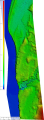
Modèle Numérique de Terrain de la commune de Grand-Santi, depuis New Libi jusqu'à Campagnie Campu.