1995
Type of resources
Available actions
Topics
Keywords
Contact for the resource
Provided by
Years
Formats
Representation types
Update frequencies
status
Scale
-

Guyadiv is a network of forest inventory plots installed in French Guiana. In Paracou experimental station 2 sets of plots pertain to the Guyadiv network Transects (> 2cm dbh) Ten 20x250m-transects have been inventoried within ten larger experimental plots. In those plots all stems > 2cm dbh have been censused (mapped and identified to species level). Plots were measured twice (once between 1994-1998, and once in 2002) 3 transects in plots subjected to treatment 1 (commercial logging only, of trees of DBH>50cm between 1986 and 1988, on average 10 stems per ha) 3 transects in plots subjected to treatment 2 (commercial logging as treatment 1 + thinning by poison-girdling of all non-commercial species of DBH≥40cm between 1986 and 1988) 3 transects in control plots (without treatments) 1 transect in plots subjected to treatment 3 (commercial logging + logging for fuelwood of all non-commercial treed of DBH between 40 and 50 cm + thinning of trees of more than 50cm DBH between 1986 and 1988) In addition 10 0.5 ha plots within the Guyaflux foot print have been set-up in which all trees > 10cm dbh have been inventoried.
-

Guyafor is a network of permanent forest plots installed in French Guiana. The Guyafor site of Nouragues covers a 3ha area (Parare plots). It is managed by CNRS. 18916 trees are being followed. 8 campaignes of inventories have been made in 1985, 1993, 1995, 2000, 2004, 2007, 2008, 2010. The bounding box of this metadata sheet represents only the extension of Parare plots.
-

The Nouragues forestry experimental site is located the Nouragues experimental station in French Guiana (other experimental sites than Nouragues plots are established in Nouragues station). This experimental site is composed by several plots not contiguous, some of them are divided into smaller plots (1ha). For each plot, the following information is recorded for all trees and lianas with DBH ≥ 10cm : 1. location of individuals inside the plot, 2. botanical identification (when it is possible), 3. diameter at breast height, or 30 cm above last aerial root, last buttress or last irregularity, 4. total height of tree (subsample). Since 2012, on Grand Plateau and Petit Plateau : 1. coefficient of light exposure 2. coefficient of infestation by lianas in tree crown.
-

Guyafor is a network of permanent forest plots installed in French Guiana. The site of Risquetout covers a 23,7ha area. It is composed of 4 plots managed by ONF. 7174 trees are being followed since 1995. 9 campaignes of inventories have been made in 1995, 1999, 2001, 2002, 2003, 2004, 2006, 2008, 2009.
-

The product "Wrecks and obstructions" contains a description of wrecks and obstructions in the French Exclusive Economic Zone (EEZ) as 2D point objects. Objects of the product "Wrecks and obstructions" are divided into 2 classes: - Wrecks (WRECKS): all or part of a stranded or sunken ship or aircraft; - Obstructions (OBSTRN): object of an artificial nature other than a wreck (for example: container, lost anchor). This product does not concern floating or drifting objects (containers, debris, buoys out of position, ...) which position changes rapidly.
-
Cet arrêté vise à maintenir le périmètre de protection de la faune sauvage aux abords du barrage de Petit-Saut. Le précédent arrêté de 1993, réglementait à la fois la protection de la faune mais également la circulation sur le plan d'eau. Dans le même temps, l'évolution législative pour l'exercice de la navigation de plaisance avec une mise en application au 1er septembre 2014, a rendu caduc l'arrêté de 1993. Un nouvel arrêté a été pris pour la navigation le 12 août 2014. Concernant la faune sauvage, les modifications législatives de ces dernières années permettent au préfet de réglementer la capture des espèces non domestiques dans le département de la Guyane (arrêté ministériel du 10 août 2006). Cet arrêté, en visant le code de l'environnement, permet d'augmenter la classe de contravention et de rendre dissuasives les peines encourues en cas d'infraction. En effet les amendes vont passer de 38€ à 750€ avec saisie du gibier et du matériel ayant servi à commettre l'infraction.
-

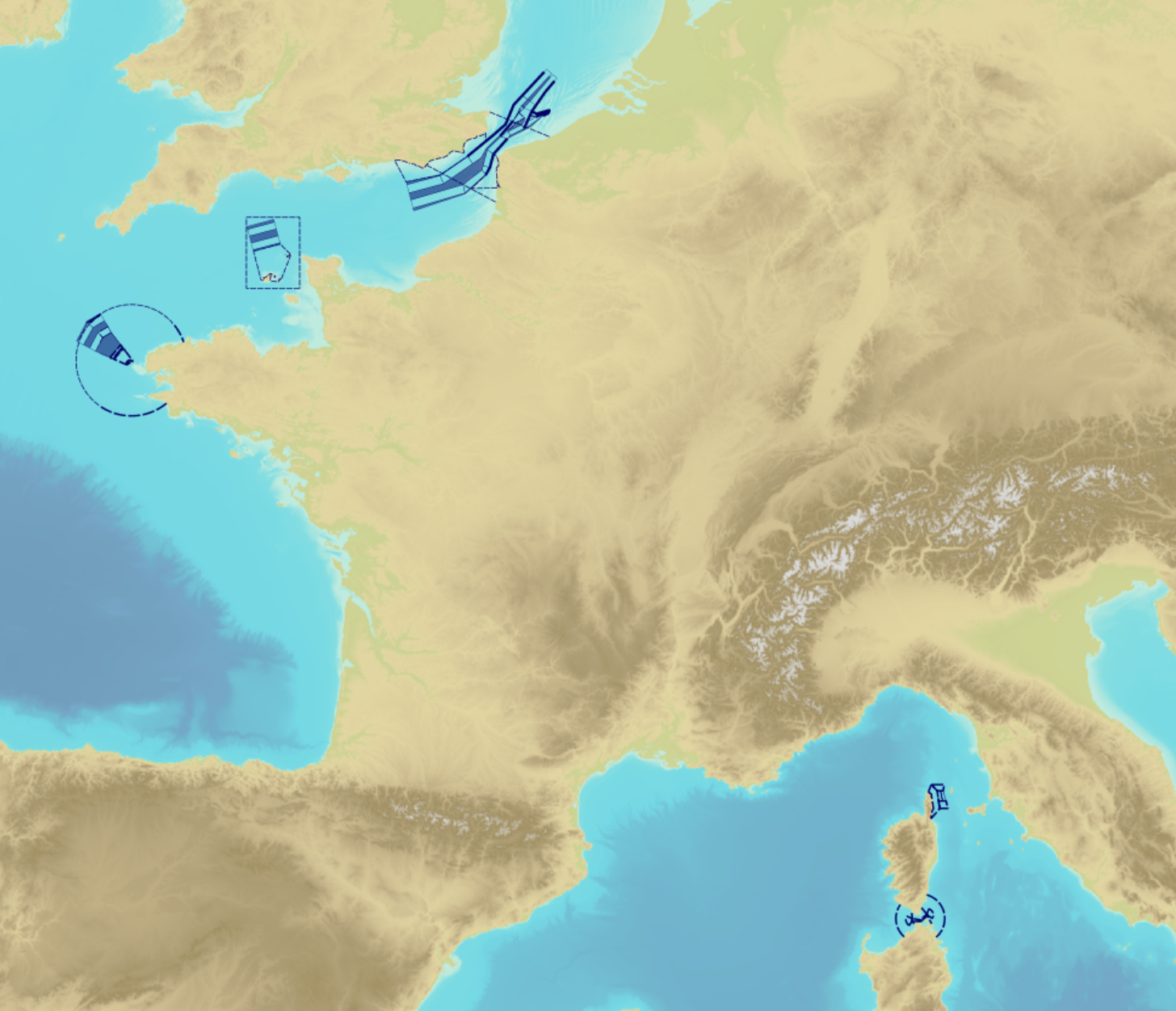
"Traffic Separation Schemes" product contains a description of TSS in French maritime spaces. A TSS is a routeing measure aimed at the separation of opposing streams of traffic by appropriate means and notably by the establishment of traffic lanes. The measures taken aim at improving navigation safety in areas where navigation is threatened by the density of traffic associated with various natural difficulties. Several classes of objects constitute this product, the acronyms used are those of IHO standard S-57: - Traffic separation scheme lane part (TSSLPT): area of a traffic lane in which the direction of flow of traffic is uniform; - Traffic separation scheme boundary (TSSBND): outer limit of a traffic lane part or a traffic separation scheme roundabout; - Traffic separation line (TSELNE): common boundary between two traffic lanes, or between one traffic lane and one inshore traffic zone; - Traffic separation zone (TSEZNE): separation areas between two traffic lanes, or between one traffic lane and one inshore traffic zone, or to the central area of a roundabout; - Inshore traffic zone (ISTZNE): area between the landward boundary of a traffic separation scheme and the adjacent coast; - Precautionary area (PRCARE): area, within defined limits, where ships must navigate with particular caution, and within which the direction of traffic flow may be recommended; - Deep water route part (DWRTPT): sections within which the flow of traffic either follows one defined direction for one-way traffic, or follows one defined direction and its reciprocal for two-way traffic. A deep-water route is a route in a designated area within defined limits which has been accurately surveyed for clearance of sea bottom and submerged obstacles to a minimum indicated depth of water; - Two-way route part (TWRTPT): sections within which traffic flows in two directions along one bearing and its reciprocal. These route parts are generally two-way, but some may be restricted to one-way traffic flow; - Radio calling-in line (RDOCAL_lne) : positions at which vessels are required to report to a traffic control centre.
-
Dans le contexte de la mise en eau du barrage de Petit-Saut, des mesures ont été prises afin d'assurer la sécurité du public et la sauvegarde de la faune. Un premier arrêté préfectoral (n°1917 du 19/10/1993) a permis de réglementer la chasse et l'accès dans un périmètre défini du plan d'eau de Petit-Saut. L'arrêté préfectoral n°2241 1D/4B modifiant celui de 1993 a redéfini le périmètre en question et les dispositions prises. A l'intérieur de ce périmètre sont interdits : "tout acte de chasse", "le transport de spécimens d'espèces animales non domestiques qu'ils soient vivants ou morts", "l'accès à pied ou en véhicules terrestres". Le transport d'armes à feu, la pénétration et la circulation sur le plan d'eau et sur les sections de cours d'eau sont réglementés.
-
The product contains a description of submarine cables and pipelines brought to the attention of Shom on French areas of responsibility. These are 2D linear objects of the seabed that divide into two categories: • The submarine cables: these are cables placed on the seabed where electricity or information (telecommunication) flows. They represent the vast majority of objects (more than 90%); • Emissaries and submarine pipes: these are pipes that allow the discharge, sampling or circulation of fluids.
-

Guyafor is a network of permanent forest plots installed in French Guiana. The site of Paracou covers a 130,5ha area. It is composed of 16 plots, managed by CIRAD. 114373 trees are being followed since 1984. 30 campaignes of inventories have been made : every year since 1984.
 Guyane-SIG