 Guyane-SIG
GeoTIFF
Type of resources
Available actions
Topics
Keywords
Contact for the resource
Provided by
Years
Formats
Representation types
Update frequencies
status
Scale
Resolution
-

The dataset estimates the carbon density (Mg C ha−1) of aboveground live woody vegetation for the pan-tropics (including tropical Africa, America and Asia) at a spatial resolution of 500 m using a combination of remote sensing and field data (for the period 2007–2008). Specifically, we used satellite-based light detection and ranging (LiDAR) data acquired at a nominal spatial resolution of 70 m together with 500 m multispectral surface reflectance imagery and other geospatial data layers.
-
Subset of the image that covers the area around Régina in French Guiana.
-

One aerial photograph (IGNF_PVA_1-0__1969-09-18__C92PHQ5671_1968_GUY19P_0137) acquired by Institut Géographique National (IGN). The image covers the area around Diane and Malmanoury in French Guiana. We used the image for the project "Feasibility study of the implementation of forest firewalls on the Guyanese Space Center".
-

Subset of the Pléiades image that covers the experimental station Nouragues in French Guiana.
-
Subset of the image that covers the area around Saint Georges in French Guiana.
-

Mosaic of color and near infrared aerial photographs. The image covers the area around Paracou in French Guiana.
-

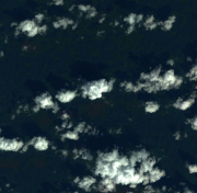
The image covers the area between Kourou and Sinnamary near the guyanese spatial center in French Guiana.
-

The satellite image covers partly the experimental site Paracou in French Guiana.
-
Subset of the image that covers the area around Saint Georges in French Guiana.
-

One aerial photograph (IGNF_PVA_1-0__1950-08-29__C92PHQ5051_1950_GUYANE2_0082) acquired by Institut Géographique National (IGN). The image covers the area around Diana and Malmanoury in French Guiana.