 Guyane-SIG
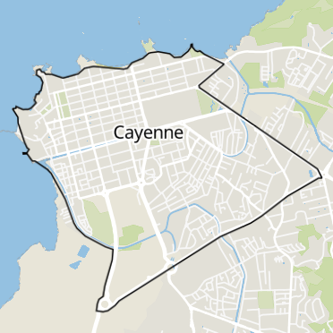
Cayenne
Type of resources
Available actions
Topics
Keywords
Contact for the resource
Provided by
Years
Formats
Representation types
Update frequencies
status
Scale
Resolution
-
The airborne data comprises laser elevation data acquired during an airborne geophysical survey over French Guiana in 1996. The study area, located along the coast in the south of Cayenne in French Guiana, measures 45 km x 55 km. The area is characterized by virgin forest and savannah. Most of the area is flat or slightly undulating, with elevation ranging from 0 to about 400 m above sea level. (e.g. Kaw mountain).
-

This “Inventaire Papetier” was conducted by the CTFT in 1975. The block covers 23 706 ha. 11 427 trees have been inventoried in 97 plots (47 ha) Pre-census DBH is 10 cm on one plot out of 10 and 15 cm in the others. DBH have been measured by classes : 10-20 cm or 15-20 cm for the first class and with a range of 10 cm since 20 cm. Plots have been located on GIS in 2006 using original maps and field note-books (indicating slopes, rivers, etc...).
-

This “Inventaire Papetier” was conducted by the CTFT in 1975. The block covers 73 113 ha. 44 091 trees have been inventoried in 288 plots (140 ha) Pre-census DBH is 15 cm on all plot (originally trees with DBH 10-15cm have been measured on one plot out of 10 but not included in the digital version) DBH have been measured by classes : 15-20 cm for the first class and with a range of 10 cm since 20 cm. Plots have been located on GIS in 2009 using original maps and field note-books (indicating slopes, rivers, etc...).
-

This “Inventaire Papetier” was conducted by the CTFT in 1975. The block covers 40 556 ha. 25 735 trees have been inventoried in 169 plots (82 ha) Pre-census DBH is 15 cm on all plot (originally trees with DBH 10-15cm have been measured on one plot out of 10 but not included in the digital version) DBH have been measured by classes : 15-20 cm for the first class and with a range of 10 cm since 20 cm. Plots have been located on GIS in 2009 using original maps and field note-books (indicating slopes, rivers, etc...).
-

The “Inventaire Papetier” was conducted by the CTFT (Centre Technique Forestier Tropical became CIRAD in 1984) and ONF between 1972 and 1976. To assess the forest resources in French Guiana, the forest was divided in large blocks along the coast (4 blocks near St Laurent, 4 blocks near Kourou and Sinnamary, 6 southern of Cayenne). Within the blocks, the forest was inventoried in 25*200m plots placed every 200-400m on parallel lines separated by 1 to 3km. The DBH was measured in 10cm classes, starting at 10cm, 15cm, or 20cm.
-

Several forest inventories in mangroves were conducted in different places and on different dates. Inventories take place at 6 main locations : Iracoubo, Sinnamary, Macouria, Cayenne, Petit Cayenne and Kaw. 1. at Iracoubo, forest inventories were carried out in 2003 and cover an area of 4800 m², 2. at Sinnamary, forest inventories were conducted in 1997, 2003 and 2004 on 9440 m², 3. at Macouria, 2824 m² were inventoried in 2006, 4. in the south-west of Cayenne, 10800 m² were inventoried in 1993, 5. at Petit-Cayenne, forest inventories were conducted in 2011 on 10000 m², 6. and in the Area of Kaw, three inventories in 2002, 2004 and 2005 cover an area of 34925 m². During the forest inventories, the collected data concern DBH, overall height or 1st branch height, the inter-trees distance in a forest plot, sometimes the surface salinity and state of the tree (living/dead).
-

This dataset gathers the description of primary occurrences of harvestmen (Opiliones) across French Guiana. The database holds 768 georeferenced records. All of the species are identified at least to the family level. Some species are identified to the genus or species level........ (Continue with the description)
-
Périmètre du programme Action Cœur de Ville (ACV) sur la commune de Cayenne, pour la période 2023-2026.
-

Emprise de la zone informée (hors NO DATA) des modèles Numérique de Terrain (MNT), de Surface (MNS) et de Hauteur (MNH) réalisés en 2015 sur les zones anthropisées de la commune de Cayenne en dehors du Domaine Forestier Permanent.
-
Modèle Numérique de Hauteur (MNH) réalisé en 2015 sur les zones anthropisées de la commune de Cayenne en dehors du Domaine Forestier Permanent. Le produit Modèle Numérique de Hauteur (MNH) est un ensemble de points 3D représentant l'élévation du terrain (différence entre le MNS et le MNT). Ici, la résolution du MNH est de 1 mètre. A noter, ce produit est également disponible aux résolutions suivantes : - 2 mètre ; - 5 mètre ; - 10 mètre ; - 20 mètre.