 Guyane-SIG
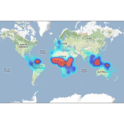
Guyana
Type of resources
Topics
Keywords
Contact for the resource
Provided by
Years
Formats
Representation types
Update frequencies
status
Scale
Resolution
-

The “Herbier IRD de Guyane” (CAY) was established in 1965 by R.A.A. Oldeman and harbors nearly 200000 specimens, mostly from French Guiana and nearby countries Suriname, Guyana, Brazil (particularly the state of Amapá), and Venezuela (state of Amazonas). The dataset presented here is the fruit of 30-years’ work by CAY’s staff as well as that of numerous other botanists who have helped make CAY a key scientific platform and leading center of botanical research for the Guiana Shield.
-

The map sheet: 1. Carte géologique des trois Guyanes = Geological map of three Guianas. Scale of 1:2 000 000. Date of publication: 1952.
-
This database contains botanical records either relating to material present in one of the Naturalis collections, or to material that has been or is being used in research projects. The records usually relate to herbarium specimens, but it also contains data on silica-gel samples, wood samples, spirit collections, carpological collections, etc.; rarely to observations only. The Naturalis collections have their strong points in The Netherlands and surrounding countries, Southeast Asia and New Guinea, West- and Central-Africa, Ethiopia and the Guyanas.