 Guyane-SIG
Imagery base maps earth cover
Type of resources
Available actions
Topics
Keywords
Contact for the resource
Provided by
Years
Formats
Representation types
Update frequencies
status
Scale
Resolution
-

The georeferenced digital image solution for the nautical chart is a digital conversion of the corresponding printed nautical chart produced by Shom or its legends, with georeferencing indications and including miscellaneous text.
-
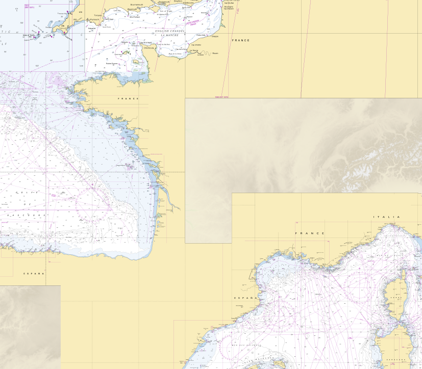
RasterMarine is a series of digital images taken from nautical charts, with no additions, legends or georeferencing information. The RasterMarine range is available at five sets of scales: - RasterMarine 20 1: 20,000 - RasterMarine 50 1: 50,000 - RasterMarine 150 1: 150,000 - RasterMarine 400 1: 400,000 - RasterMarine 1M 1: 1,000,000. Unless exceptional circumstances apply, the RasterMarine range is updated on a weekly basis and the modified grid squares are re-published, replacing the previous versions. All corrections, publications and editions with an effect on the reference nautical charts are taken into consideration. <br /> 17/04/2025 version <br />
-
Collection of aerial photographs acquired by Institut Géographique National (IGN) in French Guiana. All the aerial photographs are available for free on the IGN geoportail.
-

The dataset estimates the carbon density (Mg C ha−1) of aboveground live woody vegetation for the pan-tropics (including tropical Africa, America and Asia) at a spatial resolution of 500 m using a combination of remote sensing and field data (for the period 2007–2008). Specifically, we used satellite-based light detection and ranging (LiDAR) data acquired at a nominal spatial resolution of 70 m together with 500 m multispectral surface reflectance imagery and other geospatial data layers.
-

The image is available for free on the USGS Glovis website.
-
Subset of the image that covers the area around Régina in French Guiana.
-

The image covers the area between Kourou and Sinnamary near the guyanese spatial center.
-

The image is available for free on the USGS Glovis website.
-

The image is available for free on the USGS Glovis website.
-

One aerial photograph (IGNF_PVA_1-0__1969-09-18__C92PHQ5671_1968_GUY19P_0137) acquired by Institut Géographique National (IGN). The image covers the area around Diane and Malmanoury in French Guiana. We used the image for the project "Feasibility study of the implementation of forest firewalls on the Guyanese Space Center".