 Guyane-SIG
Oceans
Type of resources
Available actions
Topics
Keywords
Contact for the resource
Provided by
Formats
Representation types
Update frequencies
status
Scale
-
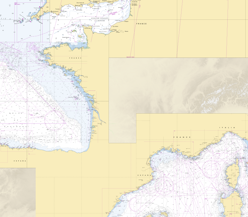
These maps are prepared on the basis of vector-based mapping data (IHO S-57 format) including the detailed description of each object (beacons, wrecks, submarine cables, regulated zones, survey systems, etc.). These maps are the digital equivalent of printed nautical charts.
-
<strong>This data is not up to date with the order dated 30 August 2021 amending the order dated 23 November 1987 on ship safety, which now raises the limit for category 4 ships to 5 miles from the nearest coast.</strong> The navigation category allocated to a ship is indicated on its shipping license, together with any applicable restrictions. This limit was produced by Shom in application of section II.14 of article 1 of decree no. 84-810 amended on 30 August 1984. Navigation categories are defined in article 110.10 of the rules appended to the order of 23 November 1987 on shipping safety.
-
Non-georeferenced digital images in JPEG2000 format from former hydrographical survey fair sheets obtained from Shom's historical archives.
-
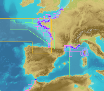
The product "Wrecks and obstructions" contains a description of wrecks and obstructions in the French Exclusive Economic Zone (EEZ) as 2D point objects. Objects of the product "Wrecks and obstructions" are divided into 2 classes: - Wrecks (WRECKS): all or part of a stranded or sunken ship or aircraft; - Obstructions (OBSTRN): object of an artificial nature other than a wreck (for example: container, lost anchor). This product does not concern floating or drifting objects (containers, debris, buoys out of position, ...) which position changes rapidly.
-

The georeferenced digital image solution for the nautical chart is a digital conversion of the corresponding printed nautical chart produced by Shom or its legends, with georeferencing indications and including miscellaneous text.
-
RasterMarine is a series of digital images taken from nautical charts, with no additions, legends or georeferencing information. The RasterMarine range is available at five sets of scales: - RasterMarine 20 1: 20,000 - RasterMarine 50 1: 50,000 - RasterMarine 150 1: 150,000 - RasterMarine 400 1: 400,000 - RasterMarine 1M 1: 1,000,000. Unless exceptional circumstances apply, the RasterMarine range is updated on a weekly basis and the modified grid squares are re-published, replacing the previous versions. All corrections, publications and editions with an effect on the reference nautical charts are taken into consideration. <br /> 17/04/2025 version <br />
-
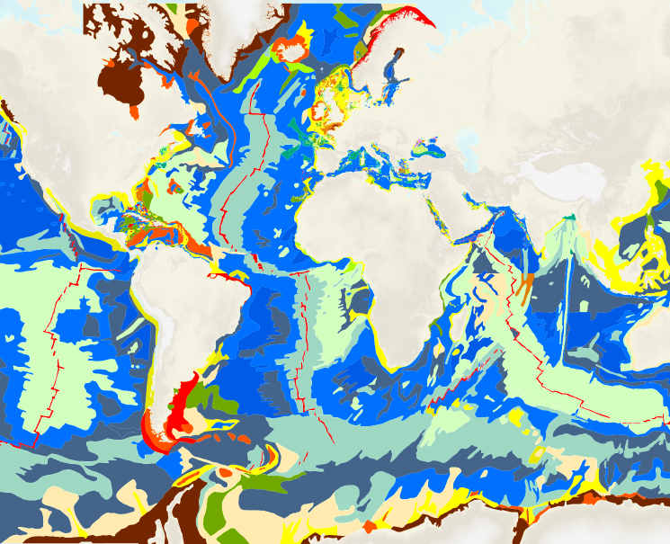
The “World Seabed Sediment Map” product contains geo-referenced digital data, describing the nature of the sediment encountered in different seas and oceans of the world. The objects are all surface areas and the description of an object includes in particular the nature of the sediment including rock-type bottoms.
-

This product shows the international distribution of types of tides. Four types of tides exist, and are classified based on the number and height of high and low waters each day: semi-diurnal tide: two high tides and two low tides with approximately the same height are recorded each day. Mixed tides with diurnal inequality: two high and low tides are recorded daily (just like with semi-diurnal tides), however the heights of the high and low waters vary significantly over the same day. Diurnal tides: one single high tide and one single low tide are recorded each day. Composite: tides can be diurnal or semi-diurnal or mixed.
-
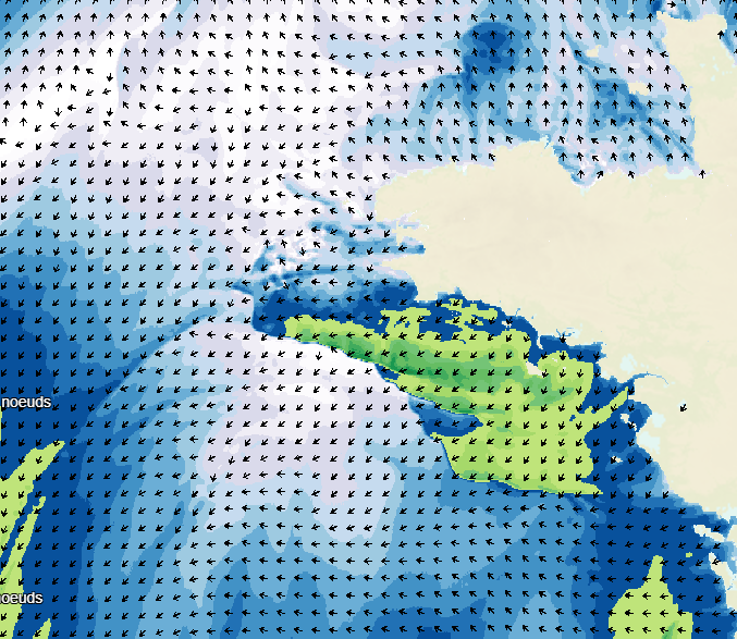
Weather forecasting models are used to show atmospheric conditions by computing changes in meteorological parameters on a 3D atmospheric grid model. Physical laws are used to determine behaviour: fluid mechanics, variation in water phase, turbulence, radiation, and atmospheric interaction with space, the continents and the oceans. The initial conditions are determined by assimilating variational data including a large volume and wide variety of in situ observations obtained from remote detection systems. The weather forecasts available on data.shom.fr only contain "wind at 10m" and "atmospheric pressure at sea level" parameters. A land/sea mask is then applied to exclude non-maritime forecasts. These forecasts are taken from 2 different types of models: ARPEGE for world and European scale input (0.5° to 0.1° resolution) and AROME for mainland France (1.3 km resolution). ARPEGE is a global hydrostatic spectral model, with variable horizontal resolution (centred on France), vertical finite element modelling and hybrid vertical coordinates. ARPEGE is an integral part of the Arpège-IFS software package, designed, developed and maintained by Météo-France in cooperation with ECMWF (European Centre for Medium-Range Weather Forecasts - http://www.ecmwf.int/). AROME is a non-hydrostatic spectral model for weather forecasts in mainland France, with finite difference modelling for vertical input and hybrid coordinates. AROME was developed by Météo-France thanks to close national (CNRS) and international (CEPMMT, Aladin, Hirlam) cooperation programmes on the basis of the Méso-NH research model and the dynamic core of the Aladin model.
-
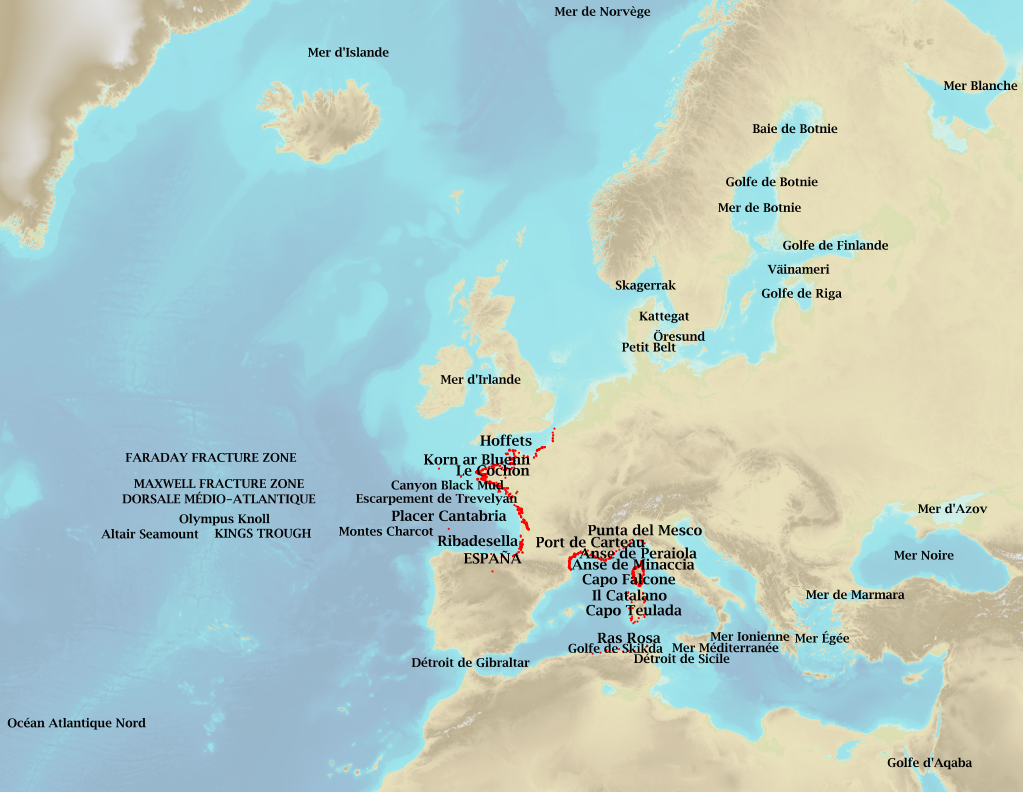
Marine toponymy data layer obtained from French ENC and created using the S23 (4th edition, June 2002). Note: The usual Sea of Japan designation does not imply taking a stand in the dispute between Korea, which names this sea "East Sea", and Japan, which names it "Sea of Japan".