 Guyane-SIG
Project DYNFORDIV
Type of resources
Available actions
Topics
Keywords
Contact for the resource
Provided by
Years
Formats
Representation types
Update frequencies
status
Resolution
-
Aerial laser scanning (ALS) dataset, Montagne Trinité, French Guiana, acquired on 24 September 2014.

The aerial laser scanning (ALS) dataset acquired on 24 September 2014 covers eastern and western side of Montagne Trinité. Data acquired in the framework of DynForDiv project. Z1 ( East side of the montain); point density: all returns 17.83 last only 10.62 (per meter square) Z2 ( West part of the moutain); point density: all returns 18.97 last only 10.61 (per meter square)
-

The aerial laser scanning (ALS) dataset acquired on 24 September 2014 covers three ares of Montagne Plomb. Z1 (North Eastern part, north of crique Plomb); point density: all returns 19.30 last only 10.62 (per meter square) Z2 (central part, Eastern part of the mountain); point density: all returns 16.80 last only 10.16 (per meter square) Z3 (most western part, western side of the mountain) ; point density: all returns 17.08 last only 10.48 (per square units) Lidar Riegl LMS Q560 onboard a plane operated by Altoa, swath angle +/-20deg
-

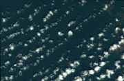
Subset of the Pléiades image that covers the experimental station Paracou in French Guiana.
-

The aerial laser scanning (ALS) dataset was acquired on 7 and 8 August 2014 in the framework of DynForDiv project. It covers mount Itoupé (altitude 830m above sea level) in French Guiana (total covered area = 72 km²). Based on sample tiles (45, 70,192, 201, 256), the mean emitted pulse density is ~12/m², and the mean echo density ~ 19/m². Lidar Riegl LMS Q560 aboard a plane operated by Altoa
-

Subset of the Pléiades image that covers the northern part of the experimental station Paracou in French Guiana.
-

Subset of the Pléiades image that covers a small area in the Northwest of Oiapoque near Saint Georges in French Guiana.
-

Subset of the Pléiades image that covers a small area south of Régina in French Guiana.
-

Subset of the Pléiades image that covers the experimental station Paracou in French Guiana.
-
Subset of the image that covers the area around Saint Georges in French Guiana.
-

Subset of the Pléiades image that covers a small area near Régina in French Guiana.