 Guyane-SIG
Spot
Type of resources
Available actions
Topics
Keywords
Contact for the resource
Provided by
Years
Formats
Representation types
Update frequencies
status
Resolution
-

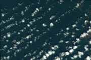
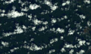
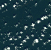
A seamless, uniform mosaic derived from 2.5-m Spot 5 satellite imagery, providing a nationwide or regional basemap for French Guiana. The images were acquired from 4 September 2007 to 16 November 2007 and 16 July 2008 to 2 November 2008. The colour basemap offers high geometric accuracy. The estimated horizontal precision is about 10 meters. The colours faithfully reflect true landscape colours. Suitable for working at scales up to 1:10 000.
-

The satellite image covers the area around Cayenne in French Guiana.
-
Subset of the image that covers the area around Saint Georges in French Guiana.
-

Subset of the image that covers the area around Saint Georges in French Guiana.
-
Subset of the image that covers the area around Saint Georges in French Guiana.
-

Subset of the image that covers the area around Saint Georges in French Guiana.
-

Subset of the image that covers the experimental site Paracou in French Guiana.
-

Subset of the image that covers the experimental site Nouragues in French Guiana.
-
Subset of the image that covers the area around Régina in French Guiana.
-

The image covers the site Rivière Grand Inini in the center of French Guiana.