 Guyane-SIG
Transport
Type of resources
Available actions
Topics
Keywords
Provided by
Years
Formats
Representation types
Update frequencies
status
Scale
-
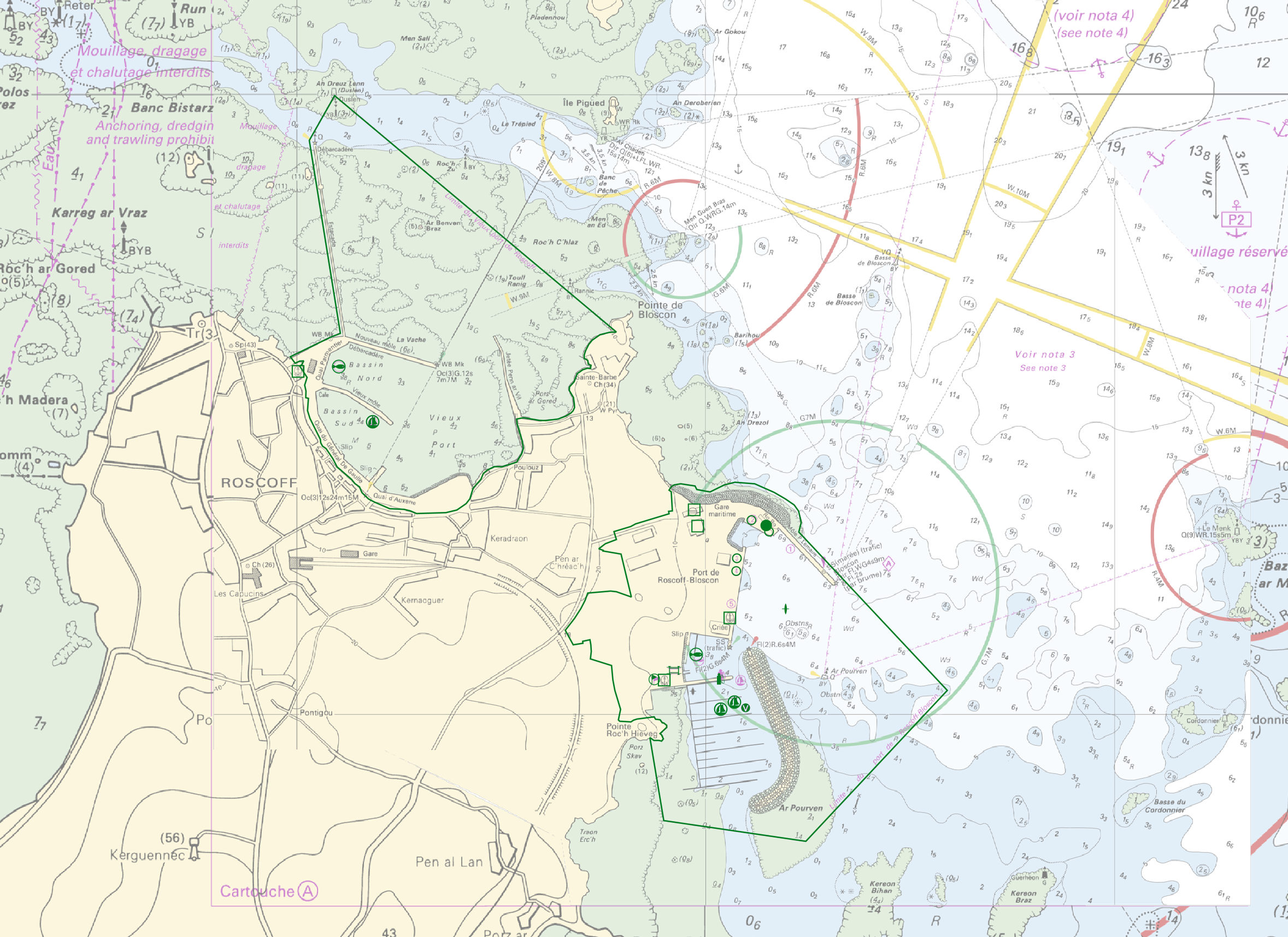
"Harbour Information" product contains 13 object classes, the acronyms used are those of IHO standard S-57 - International Hydrographic Organization – (https://iho.int/): - Berth (BERTHS): place in which a ship is moored at wharf - Isolated building localizing a harbour office (BUISGL) - Checkpoint (CHKPNT) - Crane (CRANES) - Floating dock (FLODOC): floating structure of one or more sections which can be partly submerged by controlled flooding to receive a vessel, then raised by pumping out the water so that the vessel's bottom can be exposed for maintenance. - Gridiron (GRIDRN): structure in the intertidal zone serving as a support for vessels at low tide to permit work on the exposed portion of the vessel's hull. - Harbour area (HRBARE) : administrative area of a port, including all docking and handling facilities, as well as short-term storage facilities. - Harbour facility (HRBFAC) - Hulk (HULKES) : hull of a wrecked or condemned ship, from which the fittings and superstructure have usually been removed, which is moored in a permanent position or grounded. - Oil barrier (OILBAR) - Pilot boarding place (PILBOP) - Rescue station (RSCSTA) - Small craft facility (SMCFAC) Detailed definitions of each of these object classes can be found in the S-57 standard (https://iho.int/en/standards-and-specifications). An online catalog is available at http://www.s-57.com/. Some of the symbols used for display on data.shom.fr portal have been adapted from icons from the OpenSeaMap open library (https://github.com/OpenNauticalChart/).
-
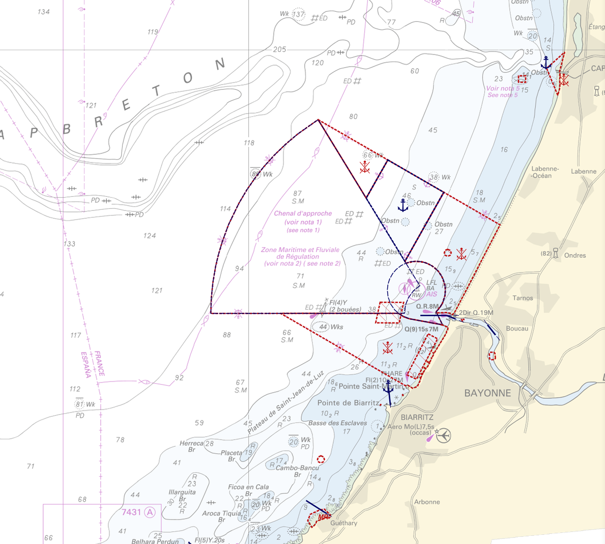
"Regulation - Navigation" product contains 18 object classes, the acronyms used are those of IHO standard S-57 - International Hydrographic Organization – (https://iho.int/): - Anchorage area (ACHARE): an area in which vessels anchor or may anchor. - Anchor berth (ACHBRT): a designated area of water where a single vessel, sea plane, etc. may anchor. - Administration Area (Named) (ADMARE) - Cable area (CBLARE) - Coastguard station (CGUSTA) - Cargo transhipment area (CTSARE) - Distance mark (DISMAR): mark indicating the distance on canals or rivers. - Dumping ground (DMPGRD): sea area where dredged material or other potentially more harmful material e.g. explosives, chemical waste, is deliberately deposited. - Fairway (FAIRWY): part of a river, harbour etc. where the main navigable channel for vessels of larger size lies. It is also the usual course followed by vessels entering or leaving harbours and sometimes called "ship channel". - Ice area (over land or water) (ICEARE) - Local magnetic anomaly (LOCMAG): anomaly of the magnetic field of the earth, extending over a relatively small area, due to local magnetic influences. - Marine farm/culture (MARCUL) - Navigation line (NAVLNE): a line generally passing through two clearly defined charted landmarks, and along part of which a vessel can approach safely. - Pipeline area (PIPARE) - Recommended track (RECTRC): track of undefined width, recommended to all or only certain vessels. - Restricted area (RESARE): specified area designated by an appropriate authority within which navigation is restricted in accordance with certain specified conditions. - Sea-plane landing area (SPLARE) Detailed definitions of each of these object classes can be found in the S-57 standard (https://iho.int/en/standards-and-specifications). An online catalog is available at http://www.s-57.com/. Some of the symbols used for display on data.shom.fr portal have been adapted from icons from the OpenSeaMap open library (https://github.com/OpenNauticalChart/). For reasons of readability, not all the characteristics of the objects are systematically displayed. All available information can be consulted by querying this layer.
-
La présente couche localise les cales et appontements relevés lors de campagnes d'inventaire conduits en 2013.
-
La donnée géolocalise les Points Routiers (PR) sur le réseau routier national en Guyane.
-
Les principales pistes (PP) forestières sont gérées par l'ONF et se situent principalement dans le domaine forestier permanent. La table attributaire comprend des informations sur la date de création de chaque piste, leur praticabilité ainsi que sur le statut juridique de la voie. Pour rappel toutes les pistes gérées par l'ONF sont interdites à la circulation publique.
-

En préalable aux études de réfection de la route d'accès au barrage de Petit-Saut (communes de Kourou et Sinnamary), la Région Guyane a acquis différents produits topographiques ainsi qu'une ortho-image technique couvrant l'intégralité de la route de Petit-Saut. L'emprise représente la zone informée (hors NO_DATA) des modèles numériques (MNT, MNS, MNH) ainsi que de l'ortho-image technique.
-

Carte scannée du plan général de voirie dans le cadre de l'aménagement du lotissement communal les Koulans de la commune de Mana.
-
Tout accident corporel de la circulation routière connu des forces de l’ordre fait l’objet d’une fiche BAAC (Bulletin d’Analyse des Accidents Corporels) par le service de police ou de gendarmerie territorialement compétent.Le fichier national des accidents corporels de la circulation, dit « fichier BAAC », regroupe l’ensemble des BAAC renseignés par les forces de l’ordre. Ce fichier BAAC constitue ainsi une base de données indispensable pour connaître l’état et l’évolution de l’insécurité routière et surtout pour comprendre les mécanismes et les facteurs explicatifs de l’accident. Ses exploitations statistiques orientent les politiques nationales et locales de sécurité routière. L’Observatoire national interministériel de la sécurité routière (ONISR) est chargé de l’administration et de la diffusion des statistiques.
-
Carte scannée des emprises des voiries communales du bourg de la commune de Grand-Santi.
-

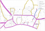
Carte scannée du plan de récolement de la voirie de la commune d'Iracoubo, secteur "Voie RN 1 - Maripa".