 Guyane-SIG
product
Type of resources
Available actions
Topics
Keywords
Provided by
Representation types
Update frequencies
Scale
-
<strong>This data is not up to date with the order dated 30 August 2021 amending the order dated 23 November 1987 on ship safety, which now raises the limit for category 4 ships to 5 miles from the nearest coast.</strong> The navigation category allocated to a ship is indicated on its shipping license, together with any applicable restrictions. This limit was produced by Shom in application of section II.14 of article 1 of decree no. 84-810 amended on 30 August 1984. Navigation categories are defined in article 110.10 of the rules appended to the order of 23 November 1987 on shipping safety.
-
Non-georeferenced digital images in JPEG2000 format from former hydrographical survey fair sheets obtained from Shom's historical archives.
-

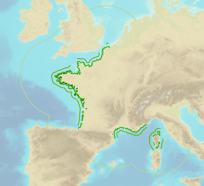
This product shows the international distribution of types of tides. Four types of tides exist, and are classified based on the number and height of high and low waters each day: semi-diurnal tide: two high tides and two low tides with approximately the same height are recorded each day. Mixed tides with diurnal inequality: two high and low tides are recorded daily (just like with semi-diurnal tides), however the heights of the high and low waters vary significantly over the same day. Diurnal tides: one single high tide and one single low tide are recorded each day. Composite: tides can be diurnal or semi-diurnal or mixed.
-
Shom is the national referent for the level of the sea in situ on all areas under French jurisdiction. In this capacity, he assures under the acronym REFMAR different coordination functions in the collection and dissemination of public data related to water level observations, in order to promote their use in multiple applications within the framework of international recommendations.
-

Shom manages a network of permanent digital coastal tide-gauges on French coasts: the RONIM Sea Level Observation Network. Most tide-gauge observatories are partnered with one or more local partners.<br /><br /> Four main types of data are available for download:<br /> - “Raw high frequency" data: raw observations neither validated nor evaluated, obtained directly from the sensor. 1-minute measurement; integration time 15 seconds (on the minute); sampling period: 1 second.<br /><br /> - "Raw non-real time" data: raw observations neither validated nor evaluated, obtained directly from the sensor. 10-minute measurement; integration time 121 seconds (around every 10 minutes); sampling period: 1 second.<br /><br /> - "Validated non-real time" data: observations checked and validated by Shom from the "Raw non-real time" data. 10-minute measurement; integration time 121 seconds (around every 10 minutes); sampling period: 1 second.<br /><br /> - "Validated hourly" data: observations checked and validated by Shom, generated from "Validated non-real time" data. Hourly measurement obtained from the Vondrak filter with triangular weighting. The hourly height cannot be calculated in the event of an observation gap greater than 1.5 hours.
-
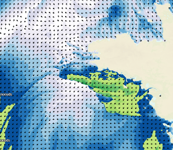
Weather forecasting models are used to show atmospheric conditions by computing changes in meteorological parameters on a 3D atmospheric grid model. Physical laws are used to determine behaviour: fluid mechanics, variation in water phase, turbulence, radiation, and atmospheric interaction with space, the continents and the oceans. The initial conditions are determined by assimilating variational data including a large volume and wide variety of in situ observations obtained from remote detection systems. The weather forecasts available on data.shom.fr only contain "wind at 10m" and "atmospheric pressure at sea level" parameters. A land/sea mask is then applied to exclude non-maritime forecasts. These forecasts are taken from 2 different types of models: ARPEGE for world and European scale input (0.5° to 0.1° resolution) and AROME for mainland France (1.3 km resolution). ARPEGE is a global hydrostatic spectral model, with variable horizontal resolution (centred on France), vertical finite element modelling and hybrid vertical coordinates. ARPEGE is an integral part of the Arpège-IFS software package, designed, developed and maintained by Météo-France in cooperation with ECMWF (European Centre for Medium-Range Weather Forecasts - http://www.ecmwf.int/). AROME is a non-hydrostatic spectral model for weather forecasts in mainland France, with finite difference modelling for vertical input and hybrid coordinates. AROME was developed by Météo-France thanks to close national (CNRS) and international (CEPMMT, Aladin, Hirlam) cooperation programmes on the basis of the Méso-NH research model and the dynamic core of the Aladin model.
-
In accordance with decree no. n°2019-165 of 5 March 2019, Shom measures and updates maritime altimetric datums or hydrographic datums for French ports in mainland France and overseas administrative departments and authorities. These datums are provided to allow for standardisation based on legal altimetric datum systems (e.g. IGN69). Shom also disseminates typical tide figures for each port (lowest tide, mean tide, etc.). The Marine Altimetric Reference Value (RAM) product is available for ports in mainland France and for overseas territories with a tidal observatory.
-

Information layer containing the SAR Zones (Search and Rescue). This layer contains a description of the French search and rescue (SAR) areas and the location of the associated Maritime Rescue Coordination Center (MRCC). it covers the areas of responsibility of France. The layer was produced by the Shom pursuant to the Circular Circular of the International Maritime Organization (IMO No. SAR.8 / Circ.4 of 1 December 2012).