 Guyane-SIG
0.3 m
Type of resources
Available actions
Topics
Keywords
Contact for the resource
Provided by
Years
Formats
Representation types
Update frequencies
status
Resolution
-
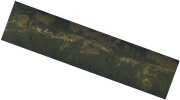
The aerial laser scanning (ALS) dataset, acquired on 11 September 2009, covers the experimental station Paracou in French Guiana. More precisely, the dataset covers 9 plots totally (Paracou 4, Paracou 5, Paracou 7, Paracou 8, Paracou 9 - Paracou 12, and Paracou 14) and 4 plots partly (Paracou 3, Paracou 6, Paracou 13, and Paracou 15). The area includes logged-over and unlogged forest, various forest heights and Pinot palm swamp forest .
-

The aerial laser scanning (ALS) dataset, acquired on October 2004, covers the experimental station Paracou in French Guiyana. More precisely, the dataset covers all Paracou plots totally except of plot 15 that is only covered partly. The area includes exploited and non-exploited forest and Pinot palm. Ground echoes are available as well as a digital terrain model (DTM), a digital surface model (DSM) , and a digital canopy model (DCM) with a 1 meter resolution.
-
The aerial laser scanning (ALS) dataset, acquired on 20 October 2009, covers the experimental station Paracou in French Guiyana. More precisely, the dataset covers 9 plots totally (Paracou 4, Paracou 5, Paracou 7, Paracou 8, Paracou 9 - Paracou 12, and Paracou 14) and 4 plots partly (Paracou 3, Paracou 6, Paracou 13, and Paracou 15). The area includes exploited and non-exploited forest and Pinot palm.
-

The aerial laser scanning (ALS) dataset, acquired between 6 and 7 April 2009, covers the experimental station Paracou in French Guiyana. More precisely, the dataset covers 9 plots totally (Paracou 4, Paracou 5, Paracou 7, Paracou 8, Paracou 9 - Paracou 12, and Paracou 14) and 4 plots partly (Paracou 3, Paracou 6, Paracou 13, and Paracou 15). The area includes exploited and non-exploited forest and Pinot palm. Ground control points are available. The Lidar data was acquired as part of the Guyafor project. It was previoulsy made available to the ESA Tropisar project. The Biomass project at Jet Propulsion Laboratory (JPL) used this dataset for the evaluation of forest structure estimation from radar data.
-

Ce produit est une orthophotographie aérienne numérique couleur de la zone anthropisée de Saint-Laurent (bourg de Saint-Laurent) du 21/09/2010 rectifiée dans la projection adaptée au territoire couvert.
-

Ce produit est une orthophotographie aérienne numérique couleur de la zone anthropisée de Saint-Laurent (Sparouine + Pimpin + Ilet Bastien) du 29/08/2012 rectifiée dans la projection adaptée au territoire couvert.
-
Ce produit est une orthophotographie aérienne numérique couleur de la zone anthropisée d'Iracoubo (Organabo) du 10/08/2012 rectifiée dans la projection adaptée au territoire couvert.
-

Ce produit est une orthophotographie aérienne numérique couleur de la zone anthropisée de Saint-Laurent (Carrefour Margot + RD9) du 13/08/2012 rectifiée dans la projection adaptée au territoire couvert.
-
Orthophotographie aérienne de la zone anthropisée de Saint-Elie de 2011 zone 1 (bourg de Saint-Elie)

Ce produit est une orthophotographie aérienne numérique couleur de la zone anthropisée de Saint-Elie (bourg de Saint-Elie) du 29/08/2011 rectifiée dans la projection adaptée au territoire couvert.
-
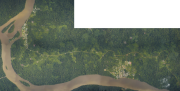
Ce produit est une orthophotographie aérienne numérique couleur de la zone anthropisée de Papaïchton (bourg de Papaïchton + bourg de Loka) du 03/09/2012 rectifiée dans la projection adaptée au territoire couvert.