 Guyane-SIG
model
Type of resources
Available actions
Topics
Keywords
Provided by
Representation types
Update frequencies
-
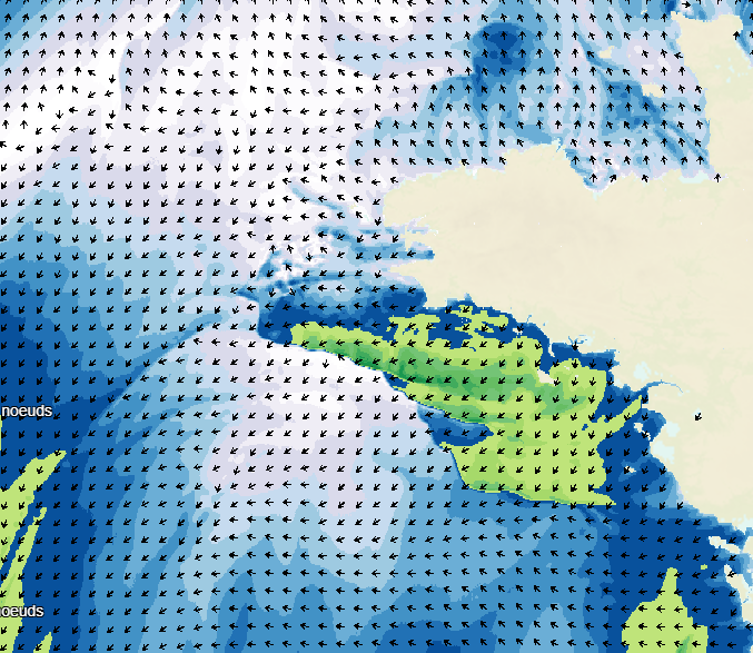
Wave forecasting models allow the representation of sea states based on a spectral resolution at the global scale or at the scale of ocean basins. This code calculates the evolution of the sea state by decomposing it into a wave spectrum that propagates in different directions and with different periods. During the propagation, the wave energy is increased or decreased by the effects of wind, breaking waves and energy exchanges between the different components. The wave forecasts available on data.shom.fr are calculated with 2 different types of models: MFWAM for the offshore domain (resolution from 0.5° to 0.1°) and Wavewatch III ® (WW3) for the coastal domain (resolution from 2' to 200m). MFWAM is a sea state forecasting model (wind wave and swell) derived from the third generation WAM code (WAMDI Group, 1988). Wavewatch III ® (WW3) is developed in a collaboration between the United States Weather Service (NOAA/NCEP), Shom, the University of Darmstadt in Germany, and other partners. The forecasts published on data.shom.fr are issued from the parameterization carried out and optimized by the Shom and Météo-France within the framework of the Homonim project (national coastal flood/wave/storm warning system).
-
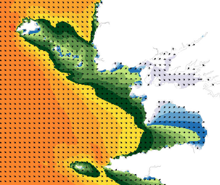
Weather forecasting models are used to show atmospheric conditions by computing changes in meteorological parameters on a 3D atmospheric grid model. Physical laws are used to determine behaviour: fluid mechanics, variation in water phase, turbulence, radiation, and atmospheric interaction with space, the continents and the oceans. The initial conditions are determined by assimilating variational data including a large volume and wide variety of in situ observations obtained from remote detection systems. The weather forecasts available on data.shom.fr only contain "wind at 10m" and "atmospheric pressure at sea level" parameters. A land/sea mask is then applied to exclude non-maritime forecasts. These forecasts are taken from 2 different types of models: ARPEGE for world and European scale input (0.5° to 0.1° resolution) and AROME for mainland France (1.3 km resolution). ARPEGE is a global hydrostatic spectral model, with variable horizontal resolution (centred on France), vertical finite element modelling and hybrid vertical coordinates. ARPEGE is an integral part of the Arpège-IFS software package, designed, developed and maintained by Météo-France in cooperation with ECMWF (European Centre for Medium-Range Weather Forecasts - http://www.ecmwf.int/). AROME is a non-hydrostatic spectral model for weather forecasts in mainland France, with finite difference modelling for vertical input and hybrid coordinates. AROME was developed by Météo-France thanks to close national (CNRS) and international (CEPMMT, Aladin, Hirlam) cooperation programmes on the basis of the Méso-NH research model and the dynamic core of the Aladin model.