 Guyane-SIG
Product
Type of resources
Available actions
Topics
Keywords
Provided by
Representation types
Update frequencies
Scale
-

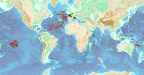
Bathymetric datasets are an extraction of surveys belonging to the Shom public database. For depth up to 50m, the vertical precision of soundings varies from 30cm to 1m and the horizontal precision varies from 1 to 20m. In deep ocean, the vertical precision is mainly around 1 or 2% of the bottom depth. It is sometimes more, it depends on the technology used. The data are referenced to ZH which is assimilated to LAT. Data are corrected for sound velocity variations. <br /> October 27 2025 version
-
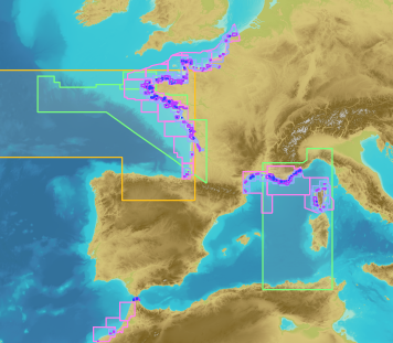
These maps are prepared on the basis of vector-based mapping data (IHO S-57 format) including the detailed description of each object (beacons, wrecks, submarine cables, regulated zones, survey systems, etc.). These maps are the digital equivalent of printed nautical charts.
-
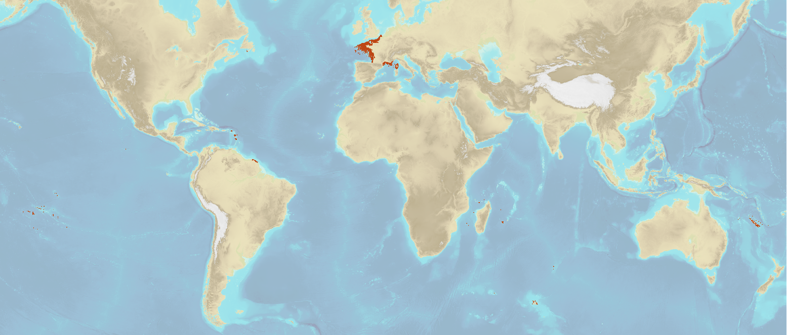
The product "Wrecks and obstructions" contains a description of wrecks and obstructions in the French Exclusive Economic Zone (EEZ) as 2D point objects. Objects of the product "Wrecks and obstructions" are divided into 2 classes: - Wrecks (WRECKS): all or part of a stranded or sunken ship or aircraft; - Obstructions (OBSTRN): object of an artificial nature other than a wreck (for example: container, lost anchor). This product does not concern floating or drifting objects (containers, debris, buoys out of position, ...) which position changes rapidly. <br /> February 17 2026 version
-

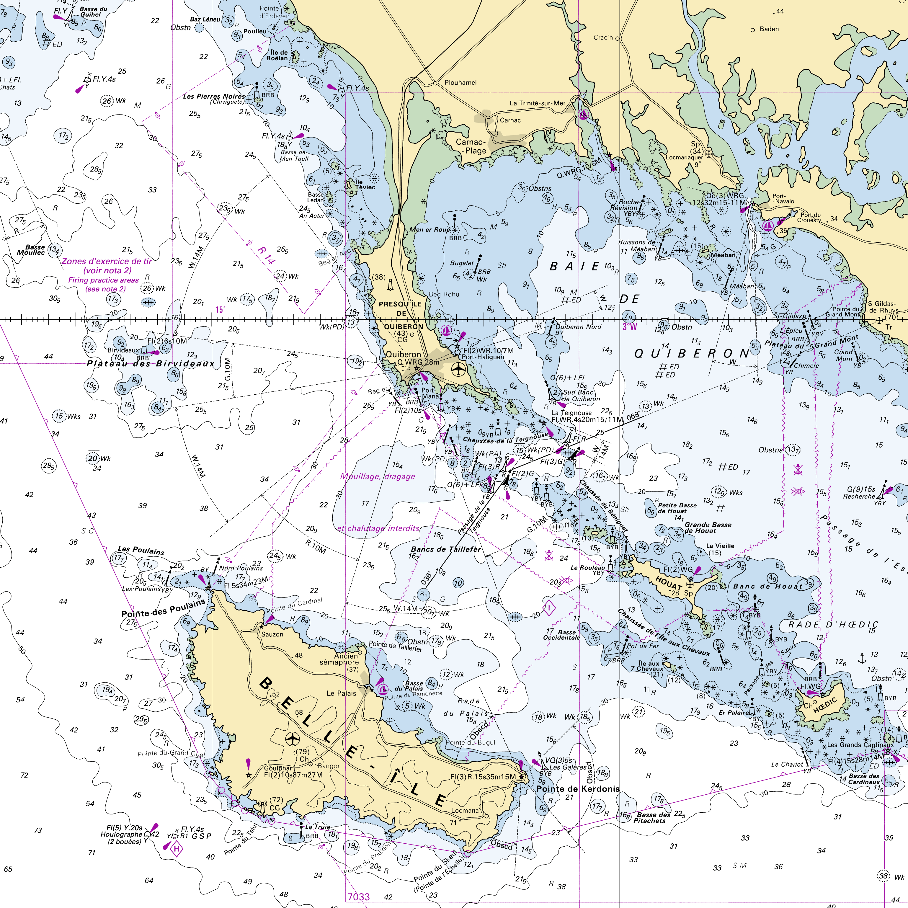
The georeferenced digital image solution for the nautical chart is a digital conversion of the corresponding printed nautical chart produced by Shom or its legends, with georeferencing indications and including miscellaneous text.
-
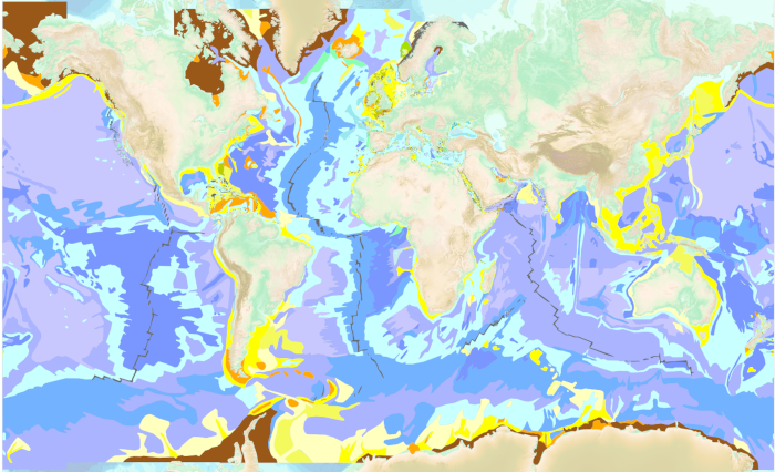
The “World Seabed Sediment Map” product contains geo-referenced digital data, describing the nature of the sediment encountered in different seas and oceans of the world. The objects are all surface areas and the description of an object includes in particular the nature of the sediment including rock-type bottoms.
-
RasterMarine is a series of digital images taken from nautical charts, with no additions, legends or georeferencing information. The RasterMarine range is available at six sets of scales: - RasterMarine10 1:10,000 - RasterMarine25 1:25,000 - RasterMarine50 1:50,000 - RasterMarine100 1:100,000 - RasterMarine350 1:350,000 - RasterMarine1M 1:1,000,000. Unless exceptional circumstances apply, the RasterMarine range is updated on a weekly basis and the modified grid squares are re-published, replacing the previous versions. All corrections, publications, editions and suppressions with an effect on the reference nautical charts are taken into consideration. <br /> 13/05/2026 version <br />