 Guyane-SIG
2014
Type of resources
Available actions
Topics
Keywords
Contact for the resource
Provided by
Years
Formats
Representation types
Update frequencies
status
Service types
Scale
Resolution
-
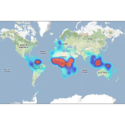
This database contains botanical records either relating to material present in one of the Naturalis collections, or to material that has been or is being used in research projects. The records usually relate to herbarium specimens, but it also contains data on silica-gel samples, wood samples, spirit collections, carpological collections, etc.; rarely to observations only. The Naturalis collections have their strong points in The Netherlands and surrounding countries, Southeast Asia and New Guinea, West- and Central-Africa, Ethiopia and the Guyanas.
-
Aerial laser scanning (ALS) dataset, Montagne Trinité, French Guiana, acquired on 24 September 2014.

The aerial laser scanning (ALS) dataset acquired on 24 September 2014 covers eastern and western side of Montagne Trinité. Data acquired in the framework of DynForDiv project. Z1 ( East side of the montain); point density: all returns 17.83 last only 10.62 (per meter square) Z2 ( West part of the moutain); point density: all returns 18.97 last only 10.61 (per meter square)
-

The aerial laser scanning (ALS) dataset acquired on 24 September 2014 covers three ares of Montagne Plomb. Z1 (North Eastern part, north of crique Plomb); point density: all returns 19.30 last only 10.62 (per meter square) Z2 (central part, Eastern part of the mountain); point density: all returns 16.80 last only 10.16 (per meter square) Z3 (most western part, western side of the mountain) ; point density: all returns 17.08 last only 10.48 (per square units) Lidar Riegl LMS Q560 onboard a plane operated by Altoa, swath angle +/-20deg
-

Subset of the image that covers the area around Saint Georges in French Guiana.
-

The aerial laser scanning (ALS) dataset acquired on 4 August 2014 covers eastern and western side of Bellevue de l'Inini mountain. Data acquired in the framework of DynForDiv project. Western transect point density: all returns 17.05 last only 9.83 (per square units) Eastern transect point density: all returns 16.83 last only 10.28 (per square units) Lidar Riegl LMS Q560 onboard a plane operated by Altoa, swath angle +/-20deg
-

Subset of the Pléiades image that covers the experimental station Nouragues in French Guiana.
-

Subset of the Pléiades image that covers a small area near Régina in French Guiana.
-

Subset of the Pléiades image that covers a small area in the Northwest of Oiapoque near Saint Georges in French Guiana.
-

Subset of the Pléiades image that covers the area near Saint Georges in French Guiana.
-

This dataset gathers the description of primary occurrences of harvestmen (Opiliones) across French Guiana. The database holds 768 georeferenced records. All of the species are identified at least to the family level. Some species are identified to the genus or species level........ (Continue with the description)