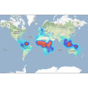
 Guyane-SIG
dataset
Type of resources
Available actions
Topics
Keywords
Contact for the resource
Provided by
Years
Formats
Representation types
Update frequencies
status
Scale
Resolution
-

The site Roche Koutou is composed of four 2 to 3km-transects (20m wide). 4411 trees with dbh>=20cm have been recorded by Office national des forêts (ONF). Fauna inventories have been made by Office national de la chasse et de la faune sauvage (ONCFS) few days after. 756 under-storey plants have been inventoried on 34 plots on this site (IRD). Soils have been described using 16 samples (1.20m depth max.). No laboratory analysis available for soils.
-

Guyadiv is a network of permanent forest plots installed in French Guiana. The site of Rivière Grand Inini is composed of two 20x500m-plots. A complete inventory has been made in 1990 : 1266 trees with dbh>=10cm have been registrated. 621 species have been identified in the first plot and 639 in the second plot. 99,7% and 99, 4% of the registrated trees have been identified to the species level, respectively on each plot. We only have the point coordinates and not the precise demarcation of the sample plots. In order to calculate the bounding box for these plots, we have expanded the point location 500 meters in each direction.
-

The site Haute Matarony is composed of four 3km-transects (20m wide). 5463 trees with dbh>=20cm have been recorded by Office National des Forêts (ONF). Fauna inventories have been made by Office national de la chasse et de la faune sauvage (ONCFS) few days after. There is no inventory of under-storey plants on this site. Soils have been described using 9 samples (1.20m depth max.). Laboratory analyses are available for one soil-profile.
-

The aerial laser scanning (ALS) dataset, acquired on 1 october 2005, covers five plots of the Montagne des Chevaux and the Montagnes des Serpents areas in French Guiana. Each subsite is covered by one data file. The Z2 data area covers a spirotropis forest type area, the Z3 data area covers a riparian vegetation with Avicenia, and the Z4 data area covers a swamp forest.
-

The aerial laser scanning (ALS) dataset, acquired in 2007, covers the research area in the Nouragues reserve. Ground echoes are available as well as a digital terrain model (DTM), a digital surface model (DSM), and a digital canopy model (DCM) with a 1 meter resolution.
-

Several forest inventories in mangroves were conducted in different places and on different dates. Inventories take place at 6 main locations : Iracoubo, Sinnamary, Macouria, Cayenne, Petit Cayenne and Kaw. 1. at Iracoubo, forest inventories were carried out in 2003 and cover an area of 4800 m², 2. at Sinnamary, forest inventories were conducted in 1997, 2003 and 2004 on 9440 m², 3. at Macouria, 2824 m² were inventoried in 2006, 4. in the south-west of Cayenne, 10800 m² were inventoried in 1993, 5. at Petit-Cayenne, forest inventories were conducted in 2011 on 10000 m², 6. and in the Area of Kaw, three inventories in 2002, 2004 and 2005 cover an area of 34925 m². During the forest inventories, the collected data concern DBH, overall height or 1st branch height, the inter-trees distance in a forest plot, sometimes the surface salinity and state of the tree (living/dead).
-
This database contains botanical records either relating to material present in one of the Naturalis collections, or to material that has been or is being used in research projects. The records usually relate to herbarium specimens, but it also contains data on silica-gel samples, wood samples, spirit collections, carpological collections, etc.; rarely to observations only. The Naturalis collections have their strong points in The Netherlands and surrounding countries, Southeast Asia and New Guinea, West- and Central-Africa, Ethiopia and the Guyanas.
-
Aerial laser scanning (ALS) dataset, Montagne Trinité, French Guiana, acquired on 24 September 2014.

The aerial laser scanning (ALS) dataset acquired on 24 September 2014 covers eastern and western side of Montagne Trinité. Data acquired in the framework of DynForDiv project. Z1 ( East side of the montain); point density: all returns 17.83 last only 10.62 (per meter square) Z2 ( West part of the moutain); point density: all returns 18.97 last only 10.61 (per meter square)
-
Subset of the image that covers the area around Régina in French Guiana.
-

Guyadiv is a network of permanent forest plots installed in French Guiana. The site of Plateau La Douane is composed of one 1ha-plot. A complete inventory of the trees with dbh>=10cm has been made in 2001: 522 trees have been registrated, 518 different species have been identified and 99,2% of the inventoried trees have been identifies to the species level. We only have the point coordinates and not the precise demarcation of the sample plot. In order to calculate the bounding box for the plots, we have expanded the point location 100 meters in each direction.